Toggle navigation
LMEC Home
Exhibitions
Georeferencing
Tools for Teachers
Collections
My Favorites
Sign Up / Log In
Search
Search the map portal
Map Collection
Map Collection
Map Sets
Search
Search
Search for
Search In
All Fields
Creator
Title
Subject
Place
Search All Digital Collections
Advanced Search
464 Results
My Search
Start Over
More Like
commonwealth:q524nd113
Remove constraint More Like: commonwealth:q524nd113
Place
North and Central America
Remove constraint Place: North and Central America
Filter your Search
Place
North and Central America
[remove]
464
United States
324
New York
41
Canada
24
Florida
20
Mississippi
18
Alabama
17
Chatham (county)
16
more
Place
»
Topic
Manuscript maps--Early works to 1800
117
Manuscript maps
21
Fortification--New York (State)--New York--Maps--Early works to 1800
11
Gulf Coast (U.S.)--Maps, Manuscript--Early works to 1800
11
New York (N.Y.)--Buildings, structures, etc--Maps, Manuscript--Early works to 1800
9
New York (N.Y.)--Maps, Manuscript--Early works to 1800
8
Saratoga Campaign, N.Y., 1777--Maps, Manuscript--Early works to 1800
8
Coasts--Florida--Maps--Early works to 1800
7
more
Topic
»
Date
Date range begin
–
Date range end
Current results range from
1700
to
1899
1700 : 1900
1700
1900
View distribution
Creator
Hills, John, (Surveyor)
18
Montrésor, John, 1736-1799
16
Dumont de Montigny
12
Bingham, William, 1752-1804
11
Adlum, John, 1759-1836
9
Washington, George, 1732-1799
9
Faden, William, 1749-1836
7
Morgan, Benjamin, (Draftsman)
7
more
Creator
»
Format
Maps/Atlases
462
Manuscripts
458
Objects/Artifacts
2
Georeferenced
Yes
5
No
459
Collection
American Revolutionary War-Era Maps
459
Library of Congress Collection
424
Newberry Library Collection
36
Maritime Charts and Atlases
29
Urban Maps
15
Boston and New England Maps
4
British Library Collection
2
Norman B. Leventhal Map & Education Center Collection
2
Available to use
Creative Commons license
426
No known restrictions
2
Search Constraints
Sort by relevance
relevance
title
date (asc)
date (desc)
Number of results to display per page
20 per page
10
per page
20
per page
50
per page
100
per page
View results as:
grid view
map view
Search Results
1.
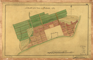
A Plan of the town of Pensacola, 1767
2.
20 tracts, Charleston
3.
Armstrong County
4.
Boston & harbour
5.
Boston Harbor, Massachusetts
6.
Carta esférica de la canal entre Puerto Rico y Santo Domingo
7.
Carte de l'entrée du port et rade de Pensacola
8.
Cawanesque
9.
Chart of the sea coast from latitude 27⁰00ʹ00ʺ to 27⁰20ʹ00ʺ, with Little Inlet & River into Hillsborough River ; Chart of the...
10.
Chart of the sea coast from lattde. 26⁰20ʹ00ʺ to 26⁰ & 40ʹ00ʺ with the head of Sharkshead River ; Chart of New Inlet ; Chart of...
11.
Costa desde la Mobila asta la Bahía de Sn. Josef
12.
Dotted line map of Washington, D.C., 1791, before Aug. 19th
13.
Draft of roads in New Jersey
14.
A draught of Lake George, and part of Hudson's River taken September 1756
15.
Fort Edward to Crown Point
16.
Jefferson, Venango & Armstrong
17.
Land ownership map of the William Bingham estate in Potter County, Pennsylvania
18.
Lines run in the Jersies for determining boundaries between that Province & New York
19.
Map of part of the city of Washington shewing the situation of the mansion house, grave yard & buildings belonging to Mr....
20.
A map of Potomack and James rivers in North America shewing their several communications with the navigable waters of the new...
+
-
Redo search here
Search when I move the map
Leaflet
| ©
OpenStreetMap
contributors, ©
CartoDB
‹ Prev
Next ›
1
2
3
4
5
…
23
24


![Chart of the sea coast from latitude 27⁰00ʹ00ʺ to 27⁰20ʹ00ʺ, with Little Inlet & River into Hillsborough River ; Chart of the sea coast from latitude 26⁰40ʹ00ʺ to [27⁰]00ʹ00ʺ, the Leech Shoal & Hillsborough River](https://bpldcassets.blob.core.windows.net/derivatives/images/commonwealth:q524nd97p/image_thumbnail_300.jpg)


