Toggle navigation
LMEC Home
Exhibitions
Georeferencing
Tools for Teachers
Collections
My Favorites
Sign Up / Log In
Search
Search the map portal
Map Collection
Map Collection
Map Sets
Search
Search
Search for
Search In
All Fields
Creator
Title
Subject
Place
Search All Digital Collections
Advanced Search
5925 Results
My Search
Start Over
More Like
commonwealth:g732h0072
Remove constraint More Like: commonwealth:g732h0072
Place
North and Central America
Remove constraint Place: North and Central America
Filter your Search
Place
North and Central America
[remove]
5,925
United States
4,843
Massachusetts
2,078
Suffolk (county)
1,044
Boston
1,017
Canada
449
New York
277
North America
233
more
Place
»
Topic
Boston (Mass.)--Maps
585
United States--Maps
281
Real property--Massachusetts--Boston--Maps
175
Massachusetts--Maps
162
Landowners--Massachusetts--Boston--Maps
133
North America--Maps--Early works to 1800
103
New England--Maps
102
City planning--Massachusetts--Boston--Maps
67
more
Topic
»
Date
Date range begin
–
Date range end
Current results range from
1525
to
2023
1525 : 2024
1525
2024
View distribution
Creator
United States. Hydrographic Office
283
O.H. Bailey & Co
146
United States. Post Office Dept
120
Des Barres, Joseph F. W. (Joseph Frederick Wallet), 1722-1824
114
Walling, Henry Francis, 1825-1888
93
Geological Survey (U.S.)
85
Wright, John Kirtland, 1891-1969
71
Boston Redevelopment Authority
70
more
Creator
»
Format
Maps/Atlases
5,907
Manuscripts
184
Books
34
Prints
18
Drawings/Illustrations
7
Objects/Artifacts
5
Posters
3
Georeferenced
Yes
698
No
5,227
Collection
Norman B. Leventhal Map & Education Center Collection
5,924
Boston and New England Maps
2,229
Urban Maps
1,828
Maritime Charts and Atlases
623
American Revolutionary War-Era Maps
566
Boston Redevelopment Authority Collection
87
MacLean Collection Map Library
1
Available to use
No known restrictions
5,809
Creative Commons license
40
Search Constraints
Sort by relevance
relevance
title
date (asc)
date (desc)
Number of results to display per page
20 per page
10
per page
20
per page
50
per page
100
per page
View results as:
grid view
map view
Search Results
1.
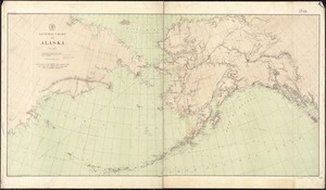
Alaska and adjoining region
2.
Alaska and adjoining territory
3.
Alaska and adjoining territory
4.
The Alaska Railroad
5.
Bacon's new large-print map of Alaska & the Klondike : compiled from the most recent government surveys and showing routes to...
6.
Colton's map of the territory of Alaska : (Russian America) ceded by Russia to the United States
7.
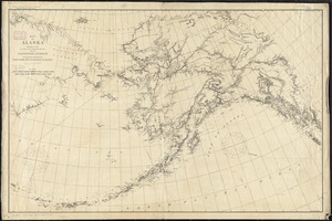
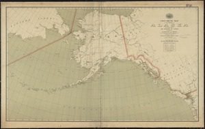
General chart of Alaska
8.
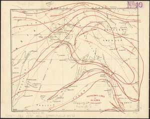
Isothermal lines of Alaska
9.
Map of Alaska
10.
Map of Alaska : showing latest explorations by U.S. Geological Survey and U.S. Coast and Geodetic Survey
11.
Map of Alaska
12.
Map of North America : showing all routes to Alaska and Klondike country
13.
Map of White Pass & Yukon Route and connections
14.
Map railway route, Seward to Fairbanks : (including Matanuska - branch)
15.
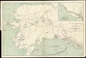
M.W. Bruce's map of Alaska
16.
North western America showing the territory ceded by Russia to the United States
17.
North western America showing the territory ceded by Russia to the United States
18.
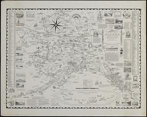
A pictorial map of Alaska, the 49th state : in Aleut "Alaska" means "great country" : population in 1958 about 215,000
19.
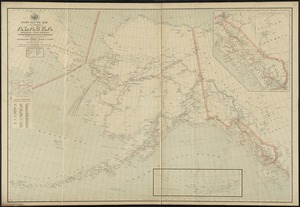
Post route map of the territory of Alaska showing post offices and the intermediate distances on mail routes in operation on...
20.
Post route map of the territory of Alaska with adjacent parts of the Dominion of Canada and portions of Washington and Oregon...
‹ Prev
Next ›
1
2
3
4
5
…
296
297