Toggle navigation
LMEC Home
Exhibitions
Georeferencing
Tools for Teachers
Collections
My Favorites
Sign Up / Log In
Search
Search the map portal
Map Collection
Map Collection
Map Sets
Search
Search
Search for
Search In
All Fields
Creator
Title
Subject
Place
Search All Digital Collections
Advanced Search
16 Results
My Search
Start Over
More Like
commonwealth-oai:x633k0531
Remove constraint More Like: commonwealth-oai:x633k0531
Creator
Robert Sayer and John Bennett (Firm)
Remove constraint Creator: Robert Sayer and John Bennett (Firm)
Filter your Search
Place
North and Central America
15
Canada
12
Longue-Pointe-de-Mingan
12
Mingan Îles de
12
Quebec
12
Saguenay
12
Saint Lawrence River
12
Sept Iles
12
more
Place
»
Topic
Longue-Pointe (Québec)--Maps
12
Mingan Islands (Québec)--Maps
12
Saguenay River (Québec)--Maps
12
Saint Lawrence River--Maps
12
Sept-Iles (Québec)--Maps
12
United States--History--Revolution, 1775-1783--Maps
4
Champlain, Lake--Maps
1
Charleston (S.C.)--Maps
1
more
Topic
»
Date
Date range begin
–
Date range end
Current results range from
1775
to
1776
1775 : 1777
1775
1777
View distribution
Creator
Robert Sayer and John Bennett (Firm)
[remove]
16
Cook, James, 1728-1779
12
Desjardins, pilot of Québec
12
Jefferys, Thomas, -1771
12
Saunders, Charles, Sir, 1713?-1775
12
Brasier, William
1
Collet, John
1
De Brahm, John Gerar William, 1717-approximately 1799
1
more
Creator
»
Format
Maps/Atlases
16
Georeferenced
No
16
Collection
American Revolutionary War-Era Maps
16
William L. Clements Library Collection
15
Richard H. Brown Revolutionary War Map Collection at Mount Vernon
1
Available to use
Creative Commons license
1
Search Constraints
Sort by relevance
relevance
title
date (asc)
date (desc)
Number of results to display per page
20 per page
10
per page
20
per page
50
per page
100
per page
View results as:
grid view
map view
Search Results
1.
A general map of the southern British colonies in America comprehending North and South Carolina, Georgia, East and West...
2.
The seat of action, between the British and American forces or an authentic plan of the western part of Long Island, with the...
3.
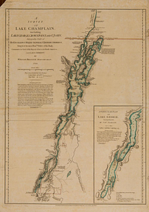
A survey of Lake Champlain, including Lake George, Crown Point and St. John : surveyed by order of his excellency Major-General...
4.
The theatre of war in North America, with the roads and a table of the distances
5.
Channels around the Island of Orleans
6.
Gaspee Bay
7.
Hare Island; Pointe aux Allouettes of Larks Point; English Bank
8.
Manicouagan Shoals; Havre St. Nicholas; Bay of the Seven Islands
9.
Part of the Anticosti Island; Mingan Island; Mignan Harbor
10.
Region of Gaspee Bay
11.
Region of Hare Island
12.
The River St. Lawrence from Mal Bay to the Basin of Quebec
13.
The River St. Lawrence from the Basin of Quebec to the Falls of Richeu
14.
The Seven Islands and the Bay
15.
The Shoals of Beauport; The River St. Lawrence from the Basin of Quebec to the Falls of Richeu
16.
St. Paul's Bay; Isle de Coudres; Great Cove; Pt. de Mille Vaches