Toggle navigation
LMEC Home
Exhibitions
Georeferencing
Tools for Teachers
Collections
My Favorites
Sign Up / Log In
Search
Search the map portal
Map Collection
Map Collection
Map Sets
Search
Search
Search for
Search In
All Fields
Creator
Title
Subject
Place
Search All Digital Collections
Advanced Search
19 Results
My Search
Start Over
More Like
commonwealth:q524nb37t
Remove constraint More Like: commonwealth:q524nb37t
Creator
Hills, John, (Surveyor)
Remove constraint Creator: Hills, John, (Surveyor)
Filter your Search
Place
North and Central America
19
United States
17
Monmouth (county)
6
Burlington (county)
4
Freehold
3
Middletown
3
Allentown
2
Camden (county)
2
more
Place
»
Topic
Middletown (N.J.)--Maps, Manuscript--Early works to 1800
3
Monmouth, Battle of, Freehold, N.J., 1778--Maps, Manuscript--Early works to 1800
3
Allentown (N.J.)--Maps, Manuscript--Early works to 1800
2
Freehold Region (N.J.)--Maps, Manuscript--Early works to 1800
2
Haddonfield (N.J.)--Maps, Manuscript--Early works to 1800
2
Manuscript maps--Early works to 1800
2
New Jersey--Maps, Manuscript--Early works to 1800
2
Roads--New Jersey--Crosswicks Region--Maps--Early works to 1800
2
more
Topic
»
Date
Date range begin
–
Date range end
Current results range from
1778
to
1881
1778 : 1882
1778
1882
View distribution
Creator
Hills, John, (Surveyor)
[remove]
19
Morgan, Benjamin, (Draftsman)
7
Clinton, Henry, Sir, 1738?-1795
1
Dennis, Anthony
1
Dunham, Azariah, 1718-1790
1
Millidge, Thomas
1
Rue, Joseph
1
Format
Maps/Atlases
19
Manuscripts
18
Georeferenced
No
19
Collection
American Revolutionary War-Era Maps
18
Library of Congress Collection
18
Urban Maps
2
Norman B. Leventhal Map & Education Center Collection
1
Available to use
Creative Commons license
18
No known restrictions
1
Search Constraints
Sort by relevance
relevance
title
date (asc)
date (desc)
Number of results to display per page
20 per page
10
per page
20
per page
50
per page
100
per page
View results as:
grid view
map view
Search Results
1.
This plan of the city of Philadelphia and it's [sic] environs, (shewing the improved parts,) is dedicated to the mayor,...
2.
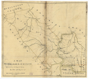
A map, Middlesex County
3.
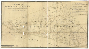
A map of Monmouth County
4.
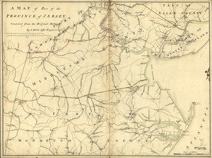
A map of part of the province of Jersey
5.
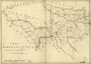
A map, Somerset County
6.
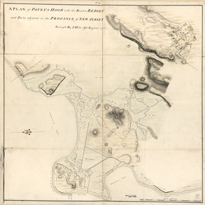
A plan of Paulus Hook with the road to Bergen and parts adjacent in the province of New Jersey
7.
Plan of the attack of Fort Clinton and Montgomery which where [sic] stormed by His Majesty's forces : under the command of Sr....
8.
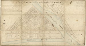
Plan of the lots laid out at Pittsburg and the Coal Hill
9.
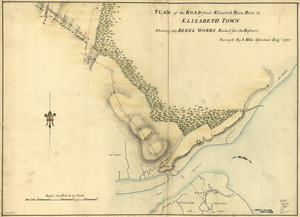
Plan of the road from Elizabeth Town Point to Elizabeth Town : shewing the rebel works raised for its defence
10.
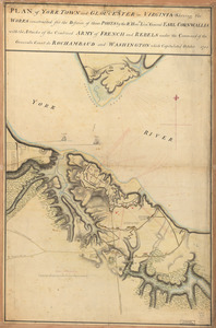
Plan of York Town and Gloucester in Virginia : shewing the works constructed for the defence of those posts by the Rt. Honble:...
11.
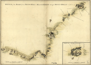
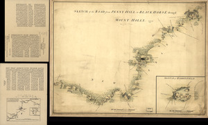
Sketch of Haddonfield, March 1778 : Sketch of the roads from Pennyhill to Black Horse through Mount Holly
12.
Sketch of Haddonfield. Sketch of the road from Penny Hill to Black Horse through Mount Holly, 1778
13.
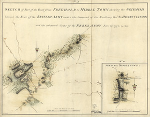
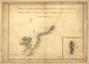
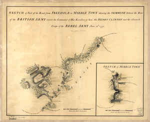
Sketch of part of the road from Freehold to Middle Town : shewing the skirmish between the rear of the British Army under the...
14.
Sketch of part of the road from Freehold to Middle Town : shewing the skirmish between the rear of the British Army under the...
15.
Sketch of part of the road from Freehold to Middle Town : shewing the skirmish between the rear of the British Army under the...
16.
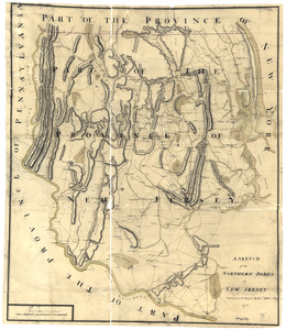
A sketch of the northern parts of New Jersey
17.
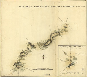
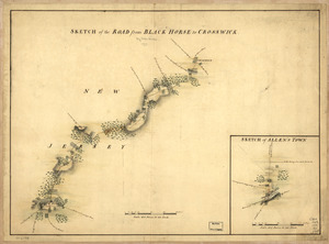
Sketch of the road from Black Horse to Crosswick
18.
Sketch of the road from Black Horse to Crosswick. Sketch of Allen's Town
19.
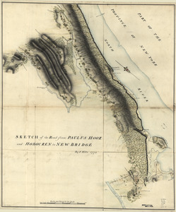
Sketch of the road from Paulus Hook and Hobocken to New Bridge
+
-
Redo search here
Search when I move the map
Leaflet
| ©
OpenStreetMap
contributors, ©
CartoDB
![This plan of the city of Philadelphia and it's [sic] environs, (shewing the improved parts,) is dedicated to the mayor, aldermen and citizens thereof](https://bpldcassets.blob.core.windows.net/derivatives/images/commonwealth:4m90fd11j/image_thumbnail_300.jpg)
![Plan of the attack of Fort Clinton and Montgomery which where [sic] stormed by His Majesty's forces](https://bpldcassets.blob.core.windows.net/derivatives/images/commonwealth:q524nj90k/image_thumbnail_300.jpg)