Toggle navigation
LMEC Home
Exhibitions
Georeferencing
Tools for Teachers
Collections
My Favorites
Sign Up / Log In
Search
Search the map portal
Map Collection
Map Collection
Map Sets
Search
Search
Search for
Search In
All Fields
Creator
Title
Subject
Place
Search All Digital Collections
Advanced Search
217 Results
My Search
Start Over
More Like
commonwealth:x059cc901
Remove constraint More Like: commonwealth:x059cc901
Format
Manuscripts
Remove constraint Format: Manuscripts
Filter your Search
Place
North and Central America
186
United States
180
Massachusetts
95
Wisconsin
46
Suffolk (county)
39
Boston
33
Middlesex (county)
12
West Virginia
10
more
Place
»
Topic
Manuscript maps
58
Boston (Mass.)--Maps, Manuscript
11
Boston (Mass.)--Maps
9
Real property--Massachusetts--Boston--Maps, Manuscript
6
Manuscript maps--Early works to 1800
5
Landowners--Massachusetts--Boston--Maps, Manuscript
4
Newton (Mass.)--Maps, Manuscript
4
Real property--Massachusetts--Boston--Maps
4
more
Topic
»
Date
Date range begin
–
Date range end
Current results range from
1620
to
1915
1620 : 1916
1620
1916
1625
1650
1675
1700
1725
1750
1775
1800
1825
1850
1875
1900
Creator
Bulfinch, Charles, 1763-1844
3
Sargent, Catharine.
3
Boston (Mass.). Engineering Dept
2
Fuller, Stephen P.
2
Pinchon, Louisa.
2
Roys, Laura A.
2
Sheafe, Jacob.
2
Thissell, J.
2
more
Creator
»
Format
Manuscripts
[remove]
217
Maps/Atlases
217
Objects/Artifacts
1
Prints
1
Georeferenced
Yes
15
No
202
Collection
Norman B. Leventhal Map & Education Center Collection
215
Boston and New England Maps
90
Urban Maps
58
American Revolutionary War-Era Maps
16
Maritime Charts and Atlases
4
Newberry Library Collection
2
Available to use
No known restrictions
215
Search Constraints
Sort by relevance
relevance
title
date (asc)
date (desc)
Number of results to display per page
20 per page
10
per page
20
per page
50
per page
100
per page
View results as:
grid view
map view
Search Results
1.
Carte d'un partie de l'Amerique Septentrionale : ou est tracée notre route d'Halifax à New York, par Quebec, Montreal, le Lac...
2.
Copy of a map presented to the Congres [sic]
3.
Africa
4.
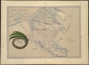
Amérique du Nord
5.
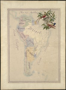
Amérique du Sud
6.
[An unfinished tracing of Joshua Fisher's copy on parchment of Oliver's paper plat of land in Dorchester, made in 1661]
7.
Approaches to Cohasset Harbor Mass. : topography surveyed in 1847 ; hydrography surveyed in 1846-'56
8.
Ashland & Bayfield
9.
Barron County, Wis.
10.
Becket
11.
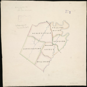
Berkley Co., W. Va
12.
A block of 6 brick houses the property of Isaac Stebbins Esquire
13.
Bloomingville, [Ohio]
14.
[Boston wharves, from Long Wharf]
15.
British Isles and Ireland
16.
Brooke Co., West Virginia
17.
Brookfield
18.
Brown County, Wis. & Kewaunee County, Wis.
19.
Buffalo County, Wis.
20.
Burnett County, Wis.
+
-
Redo search here
Search when I move the map
Leaflet
| ©
OpenStreetMap
contributors, ©
CartoDB
‹ Prev
Next ›
1
2
3
4
5
…
10
11

![Copy of a map presented to the Congres [sic]](https://bpldcassets.blob.core.windows.net/derivatives/images/commonwealth:z603vn16x/image_thumbnail_300.jpg)

![[An unfinished tracing of Joshua Fisher's copy on parchment of Oliver's paper plat of land in Dorchester, made in 1661]](https://bpldcassets.blob.core.windows.net/derivatives/images/commonwealth:wd376179d/image_thumbnail_300.jpg)


![Bloomingville, [Ohio]](https://bpldcassets.blob.core.windows.net/derivatives/images/commonwealth:1v53jx86m/image_thumbnail_300.jpg)
![[Boston wharves, from Long Wharf]](https://bpldcassets.blob.core.windows.net/derivatives/images/commonwealth:9s161966z/image_thumbnail_300.jpg)


