Toggle navigation
LMEC Home
Exhibitions
Georeferencing
Tools for Teachers
Collections
My Favorites
Sign Up / Log In
Search
Search the map portal
Map Collection
Map Collection
Map Sets
Search
Search
Search for
Search In
All Fields
Creator
Title
Subject
Place
Search All Digital Collections
Advanced Search
14164 Results
Filter your Search
Place
North and Central America
10,832
United States
8,868
Massachusetts
2,832
Suffolk (county)
1,688
Boston
1,644
Europe
1,428
Canada
1,010
New York
684
more
Place
»
Topic
Boston (Mass.)--Maps
753
City planning--Massachusetts--Boston--Maps
419
United States--History--Revolution, 1775-1783--Maps
331
United States--Maps
331
Real property--Massachusetts--Boston--Maps
254
Urban renewal--Massachusetts--Boston--Maps
254
North America--Maps--Early works to 1800
241
Massachusetts--Maps
236
more
Topic
»
Date
Date range begin
–
Date range end
Current results range from
1482
to
2023
View distribution
Creator
United States. Hydrographic Office
597
Boston Redevelopment Authority
404
Des Barres, Joseph F. W. (Joseph Frederick Wallet), 1722-1824
247
Jefferys, Thomas, -1771
172
United States. National Ocean Service
170
Royal United Services Institute for Defence and Security Studies
160
George, III, King of Great Britain, 1738-1820
152
George, IV, King of Great Britain, 1762-1830
151
more
Creator
»
Format
Maps/Atlases
13,978
Manuscripts
985
Prints
102
Books
53
Drawings/Illustrations
44
Photographs
15
Objects/Artifacts
13
Documents
7
more
Format
»
Georeferenced
Yes
979
No
13,185
Collection
Norman B. Leventhal Map & Education Center Collection
9,162
American Revolutionary War-Era Maps
3,629
Boston and New England Maps
2,936
Urban Maps
2,511
Maritime Charts and Atlases
1,169
William L. Clements Library Collection
910
Library of Congress Collection
618
Boston Redevelopment Authority Collection
475
more
Collection
»
Available to use
No known restrictions
10,408
Creative Commons license
1,678
Search Constraints
Sort by relevance
relevance
title
date (asc)
date (desc)
Number of results to display per page
20 per page
10
per page
20
per page
50
per page
100
per page
View results as:
grid view
map view
Search Results
8221.
Official highway map of the state of Vermont
8222.
Official map of American and Canadian airways and aerial mail routes
8223.
Official map of Boston
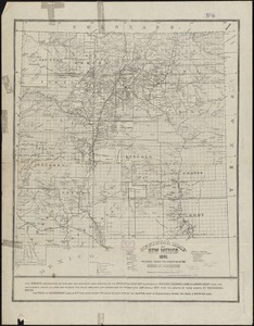
8224.
Official map of New Mexico
8225.
The official map of New York : compiled from United States government surveys, official state surveys, and other sources
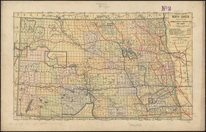
8226.
Official map of North Dakota
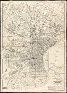
8227.
Official map of the Philadelphia Rapid Transit Co
8228.
Official map of the state of Virginia : from actual surveys by order of the executive, 1828 & 1859
8229.
Official map of the territory of Dakota, showing the two general divisions of Dakota, South and North, the land districts,...
8230.
The official map of the world : showing the four quarters of the globe on the quarter-spherical or orange peel projection
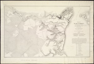
8231.
Official plan of the siege of Yorktown, Va. conducted by the Army of the Potomac under command of Maj. Gen. George B....
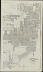
8232.
The official plat "City of Miami," Florida
8233.
Official topographical atlas of Massachusetts : from astronomical, trigonometrical and various local surveys
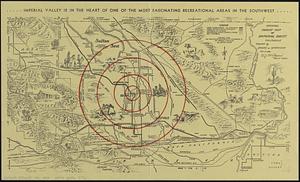
8234.
Official tourist map of Imperial County, California
8235.
Off-street parking inventory for the Boston regional core
8236.
Off-street parking inventory within Boston proper
8237.
Off-street parking inventory within Boston proper
8238.
Ohio and N.W. Territory
8239.
Ohio boundary no. 1 South Bend of Lake Michigan : map, exhibiting the position occupied in the determination of the latitude of...
8240.
Ohio boundary no. 1 South Bend of Lake Michigan : map, exhibiting the position occupied in the determination of the latitude of...
‹ Prev
Next ›
1
2
…
408
409
410
411
412
413
414
415
416
…
708
709