Toggle navigation
LMEC Home
Exhibitions
Georeferencing
Tools for Teachers
Collections
My Favorites
Sign Up / Log In
Search
Search the map portal
Map Collection
Map Collection
Map Sets
Search
Search
Search for
Search In
All Fields
Creator
Title
Subject
Place
Search All Digital Collections
Advanced Search
13420 Results
Filter your Search
Place
North and Central America
10,146
United States
8,284
Massachusetts
2,724
Suffolk (county)
1,665
Boston
1,622
Europe
1,386
Canada
949
New York
640
more
Place
»
Topic
Boston (Mass.)--Maps
742
City planning--Massachusetts--Boston--Maps
418
United States--History--Revolution, 1775-1783--Maps
329
United States--Maps
315
Urban renewal--Massachusetts--Boston--Maps
254
Real property--Massachusetts--Boston--Maps
252
Massachusetts--Maps
224
Insurance surveys
197
more
Topic
»
Date
Date range begin
–
Date range end
Current results range from
1482
to
2023
View distribution
Creator
United States. Hydrographic Office
595
Boston Redevelopment Authority
403
Des Barres, Joseph F. W. (Joseph Frederick Wallet), 1722-1824
247
Royal United Services Institute for Defence and Security Studies
160
Jefferys, Thomas, -1771
154
George, III, King of Great Britain, 1738-1820
152
George, IV, King of Great Britain, 1762-1830
151
O.H. Bailey & Co
148
more
Creator
»
Format
Maps/Atlases
13,240
Manuscripts
985
Prints
102
Books
49
Drawings/Illustrations
44
Photographs
15
Objects/Artifacts
13
Documents
7
more
Format
»
Georeferenced
Yes
979
No
12,441
Collection
Norman B. Leventhal Map & Education Center Collection
8,926
American Revolutionary War-Era Maps
3,305
Boston and New England Maps
2,839
Urban Maps
2,402
Maritime Charts and Atlases
1,150
William L. Clements Library Collection
910
Library of Congress Collection
618
Boston Redevelopment Authority Collection
475
more
Collection
»
Available to use
No known restrictions
9,987
Creative Commons license
1,677
Search Constraints
Sort by relevance
relevance
title
date (asc)
date (desc)
Number of results to display per page
20 per page
10
per page
20
per page
50
per page
100
per page
View results as:
grid view
map view
Search Results
13281.
Whale chart
13282.
What the administration has done : map showing the progress of the national armies during the years 1861, 1862, 1863, and 1864
13283.
What's up? South! : world map
13284.
Where the fight will be centered, if there is one
13285.
Whippy Harbour, south side of Viti Levu ; Suva Harbour, south side of Viti Levu ; Granby Harbour, south side of Viti Levu ;...
13286.
White Haven
13287.
White Haven
13288.
White Haven
13289.
White Haven
13290.
White Haven
13291.
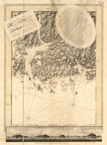
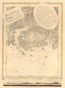
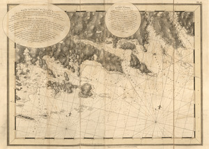
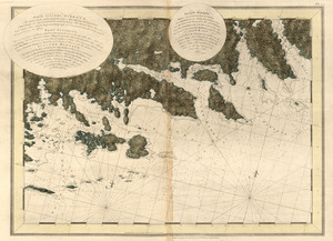
White Islands Harbour : Port Stephen's ; Liscomb Harbour ; Houlton Harbour ; River St. Mary
13292.
White Islands Harbour ; Port Stephen's ; Liscomb Harbour ; Houlton Harbour ; River St. Mary
13293.
White Islands Harbour ; Port Stephen's ; Liscomb Harbour ; Houlton Harbour ; River St. Mary
13294.
White Islands Harbour ; Port Stephen's ; Liscomb Harbour ; Houlton Harbour ; River St. Mary
13295.
White Mountain National Forest : New Hampshire-Maine
13296.
White Mountain region, New Hampshire : showing lands being acquired by the United States
13297.
The White Mountains of New Hampshire
13298.
White Plains
13299.
Whitinsville, Mass.
13300.
Whitinsville, Massachusetts : 1891
‹ Prev
Next ›
1
2
…
661
662
663
664
665
666
667
668
669
670
671