Toggle navigation
LMEC Home
Exhibitions
Georeferencing
Tools for Teachers
Collections
My Favorites
Sign Up / Log In
Search
Search the map portal
Map Collection
Map Collection
Map Sets
Search
Search
Search for
Search In
All Fields
Creator
Title
Subject
Place
Search All Digital Collections
Advanced Search
13694 Results
Filter your Search
Place
North and Central America
10,354
United States
8,484
Massachusetts
2,796
Suffolk (county)
1,678
Boston
1,634
Europe
1,419
Canada
950
New York
650
more
Place
»
Topic
Boston (Mass.)--Maps
748
City planning--Massachusetts--Boston--Maps
418
United States--History--Revolution, 1775-1783--Maps
329
United States--Maps
322
Real property--Massachusetts--Boston--Maps
254
Urban renewal--Massachusetts--Boston--Maps
254
Massachusetts--Maps
233
Insurance surveys
197
more
Topic
»
Date
Date range begin
–
Date range end
Current results range from
1482
to
2023
View distribution
Creator
United States. Hydrographic Office
597
Boston Redevelopment Authority
404
Des Barres, Joseph F. W. (Joseph Frederick Wallet), 1722-1824
247
Royal United Services Institute for Defence and Security Studies
160
Jefferys, Thomas, -1771
154
George, III, King of Great Britain, 1738-1820
152
George, IV, King of Great Britain, 1762-1830
151
O.H. Bailey & Co
148
more
Creator
»
Format
Maps/Atlases
13,513
Manuscripts
985
Prints
102
Books
49
Drawings/Illustrations
44
Photographs
15
Objects/Artifacts
13
Documents
7
more
Format
»
Georeferenced
Yes
979
No
12,715
Collection
Norman B. Leventhal Map & Education Center Collection
9,108
American Revolutionary War-Era Maps
3,305
Boston and New England Maps
2,921
Urban Maps
2,480
Maritime Charts and Atlases
1,169
William L. Clements Library Collection
910
Library of Congress Collection
618
Boston Redevelopment Authority Collection
475
more
Collection
»
Available to use
No known restrictions
10,260
Creative Commons license
1,678
Search Constraints
Sort by relevance
relevance
title
date (asc)
date (desc)
Number of results to display per page
20 per page
10
per page
20
per page
50
per page
100
per page
View results as:
grid view
map view
Search Results
5241.
Map of Lynn and Saugus : settled in 1629
5242.
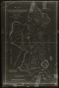
Map of Lynnfield, in Essex County, Massachusetts
5243.
A map of Mackenzie's track from Fort Chipewyan to the Pacific Ocean in 1793
5244.
Map of Madison and the Four Lake Country, Dane Co. Wis
5245.
Map of Madison County, Virginia : prepared under the direction of P.S. Michie
5246.
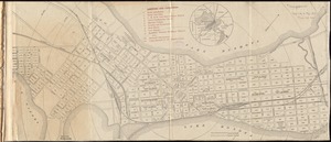
Map of Madison, Wisconsin : A.A.A.S. XLII meeting, August 17-24, 1893
5247.
Map of Maine for the Maine register
5248.
Map of Maine, New Hampshire, and Vermont : compiled from the latest authorities
5249.
Map of Maine, New Hampshire and Vermont, from the most authentic sources
5250.
Map of Maine, New Hampshire, Vermont, Massachusetts, Rhode Island, and Connecticut : exhibiting the post offices, post roads,...
5251.
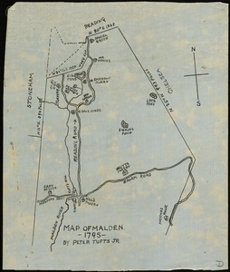
Map of Malden, 1795
5252.
Map of Malta and its dependencies
5253.
Map of Manchuria, Corea & Japan
5254.
Map of maneuver ground, Massachusetts, 1909
5255.
Map of Manitoba
5256.
Map of Manitoba
5257.
Map of Manitoba
5258.
Map of Manitoba, Saskatchewan & Alberta : showing the number of quarter sections available for homestead entry in each...
5259.
Map of Manitoba, Saskatchewan and Alberta : showing the number of quarter sections available for homestead entry in each township
5260.
Map of Manitoba, Saskatchewan and Alberta : showing the number of quarter-sections available for homestead entry in each...
‹ Prev
Next ›
1
2
…
259
260
261
262
263
264
265
266
267
…
684
685