Toggle navigation
LMEC Home
Exhibitions
Georeferencing
Tools for Teachers
Collections
My Favorites
Sign Up / Log In
Search
Search the map portal
Map Collection
Map Collection
Map Sets
Search
Search
Search for
Search In
All Fields
Creator
Title
Subject
Place
Search All Digital Collections
Advanced Search
13680 Results
Filter your Search
Place
North and Central America
10,344
United States
8,475
Massachusetts
2,789
Suffolk (county)
1,677
Boston
1,633
Europe
1,415
Canada
950
New York
649
more
Place
»
Topic
Boston (Mass.)--Maps
747
City planning--Massachusetts--Boston--Maps
418
United States--History--Revolution, 1775-1783--Maps
329
United States--Maps
322
Real property--Massachusetts--Boston--Maps
254
Urban renewal--Massachusetts--Boston--Maps
254
Massachusetts--Maps
231
Insurance surveys
197
more
Topic
»
Date
Date range begin
–
Date range end
Current results range from
1482
to
2023
View distribution
Creator
United States. Hydrographic Office
597
Boston Redevelopment Authority
404
Des Barres, Joseph F. W. (Joseph Frederick Wallet), 1722-1824
247
Royal United Services Institute for Defence and Security Studies
160
Jefferys, Thomas, -1771
154
George, III, King of Great Britain, 1738-1820
152
George, IV, King of Great Britain, 1762-1830
151
O.H. Bailey & Co
148
more
Creator
»
Format
Maps/Atlases
13,499
Manuscripts
985
Prints
102
Books
49
Drawings/Illustrations
44
Photographs
15
Objects/Artifacts
13
Documents
7
more
Format
»
Georeferenced
Yes
979
No
12,701
Collection
Norman B. Leventhal Map & Education Center Collection
9,096
American Revolutionary War-Era Maps
3,305
Boston and New England Maps
2,915
Urban Maps
2,471
Maritime Charts and Atlases
1,169
William L. Clements Library Collection
910
Library of Congress Collection
618
Boston Redevelopment Authority Collection
475
more
Collection
»
Available to use
No known restrictions
10,246
Creative Commons license
1,678
Search Constraints
Sort by relevance
relevance
title
date (asc)
date (desc)
Number of results to display per page
20 per page
10
per page
20
per page
50
per page
100
per page
View results as:
grid view
map view
Search Results
3041.
Dominion of Canada, Gulf of St. Lawrence, Pictou Harbor (Nova Scotia) : from British surveys in 1843 & 80
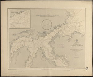
3042.
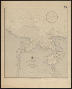
Dominion of Canada, Gulf of St. Lawrence, Pugwash Harbor (Nova Scotia) : from a British survey in 1840
3043.
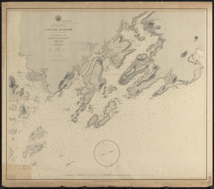
Dominion of Canada, New Brunswick, L'Etang Harbor (Bay of Fundy) : from a British survey in 1847
3044.
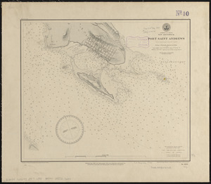
Dominion of Canada, New Brunswick, Port Saint Andrews (Passamaquoddy Bay) : from a British survey in 1844
3045.
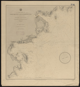
Dominion of Canada, Nova Scotia - south coast, Port Mouton and Liverpool Bay : from a British survey in 1861-62
3046.
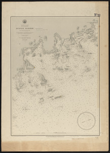
Dominion of Canada, Nova Scotia, Beaver Harbor : from a British survey in 1857
3047.
Dominion of Canada, Nova Scotia, Country Harbor : from a British survey in 1855
3048.
Dominion of Canada, Nova Scotia, Guysborough Harbor (Chedabucto Bay) : from a British survey in 1850
3049.
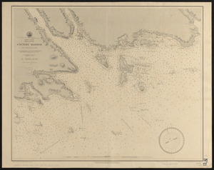
Dominion of Canada, Nova Scotia, Ship Harbor and adjacent anchorages : from a British survey in 1854
3050.
Dominion of Canada, Nova Scotia, Whitehaven : from a British survey in 1855
3051.
Dominion of Canada, Prince Edward Island, Hillsborough Bay and Charlottetown Harbor : from British surveys in 1842 & 43
3052.
La Dominique située entre La Martinique et La Guadeloupe : conquise par M. le Mis. de Bouillé Marechal des camps et armées du...
3053.
Done by order of His excellency Montagu Wilmot, Esq. Governor and Commander in Chief of Nova Scotia, &c., &., &
3054.
Dongguk yojido
3055.
Door County, Wis.
3056.
Dorchester Bay
3057.
Dorchester improvement area, map no. 2 - south east
3058.
[Dorchester Neck]
3059.
Dot matrix printouts of Landsat satellite images
3060.
Dotted line map of Washington, D.C., 1791, before Aug. 19th
‹ Prev
Next ›
1
2
…
149
150
151
152
153
154
155
156
157
…
683
684


![[Dorchester Neck]](https://bpldcassets.blob.core.windows.net/derivatives/images/commonwealth:dz010v59b/image_thumbnail_300.jpg)