Toggle navigation
LMEC Home
Exhibitions
Georeferencing
Tools for Teachers
Collections
My Favorites
Sign Up / Log In
Search
Search the map portal
Map Collection
Map Collection
Map Sets
Search
Search
Search for
Search In
All Fields
Creator
Title
Subject
Place
Search All Digital Collections
Advanced Search
2888 Results
My Search
Start Over
atlas
Remove constraint atlas
Filter your Search
Place
North and Central America
1,673
United States
1,009
Europe
470
Massachusetts
359
Canada
271
South America
193
Asia
192
Suffolk (county)
165
more
Place
»
Topic
Landowners--Massachusetts--Boston--Maps
115
Real property--Massachusetts--Boston--Maps
106
United States--Maps
87
Boston (Mass.)--Maps
64
United States--History--French and Indian War, 1754-1763--Maps
63
Saint Lawrence River--Maps
41
Nautical charts--Early works to 1800
39
North America--Maps--Early works to 1800
36
more
Topic
»
Date
Date range begin
–
Date range end
Current results range from
1482
to
2023
View distribution
Creator
United States. Hydrographic Office
584
Des Barres, Joseph F. W. (Joseph Frederick Wallet), 1722-1824
118
Ptolemy, 2nd cent
100
Bromley, George Washington
99
Bromley, Walter Scott
97
G.W. Bromley & Co.
75
Carey, Mathew, 1760-1839
74
Paullin, Charles Oscar, 1868 or 1869-1944
70
more
Creator
»
Format
Maps/Atlases
2,872
Manuscripts
58
Books
37
Prints
8
Documents
5
Drawings/Illustrations
1
Georeferenced
Yes
142
No
2,746
Collection
Norman B. Leventhal Map & Education Center Collection
2,431
Maritime Charts and Atlases
1,169
American Revolutionary War-Era Maps
504
Boston and New England Maps
386
Urban Maps
271
Massachusetts Real Estate Atlases
144
William L. Clements Library Collection
92
Mapping Boston Collection
61
more
Collection
»
Available to use
No known restrictions
2,337
Creative Commons license
158
Search Constraints
Sort by relevance
relevance
title
date (asc)
date (desc)
Number of results to display per page
20 per page
10
per page
20
per page
50
per page
100
per page
View results as:
grid view
map view
Search Results
2441.
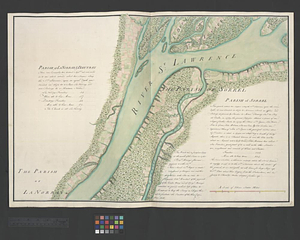
Parish of La Norray & Dautray. Parish of Sorrel
2442.
Parish of L'Assomption. Parish of St. Sulpice
2443.
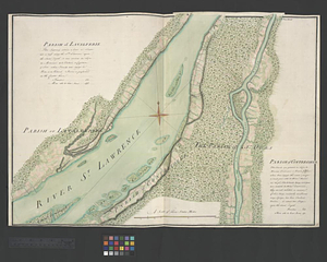
Parish of Lavalterie. Parish of Contrecoeur
2444.
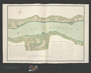
Parish of Magdelaine. Parish of Becancour
2445.
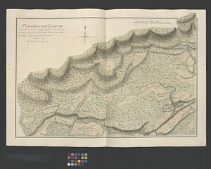
Parish of Old Lorette
2446.
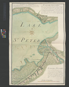
Parish of Omchis. Parish of Pointe du Lac. Parish of Nicolet
2447.
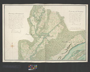
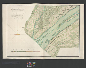
Parish of Repentigny
2448.
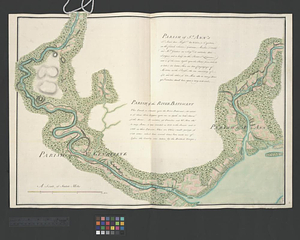
Parish of St. Ann's. Parish of the River Batiscant
2449.
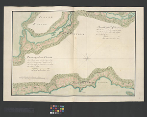
Parish of St. Genevieve. Parish of Pointe Claire
2450.
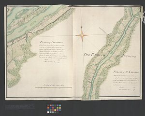
Parish of St. Joachim. Parish of St. Famille. Parish of St. Anne. Parish of St. François
2451.
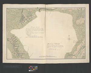
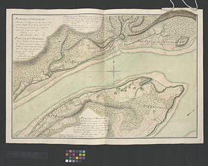
Parish of St. Joseph [of Masquinonge]. Parish of the River du Loup
2452.
Parish of St. Michelle. Parish of St. John Baptist. Parish of St. Vertier
2453.
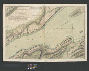
Parish of Vercheres. Parish of St. Antoine
2454.
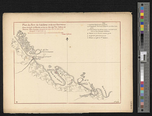
Plan du port de Calidone et de ses environs dans le Golfe de Darien et sur la cote septle de l'isthme de Panama
2455.
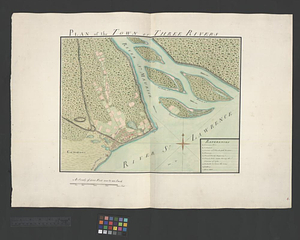
Plan of the town of Three Rivers
2456.
Point Levi. Parish of St. Charles
2457.
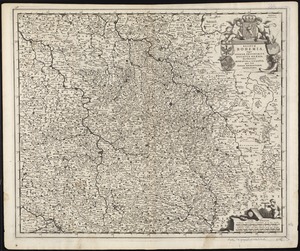
Regnum Bohemia, eique annexae provinciae, ut Ducatus Silesia, marchionatus Moravia, et Lusatia : quae sunt terrae Haereditariae...
2458.
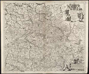
Regnum Bohemia, eique annexae provinciae ut Ducatus Silesia marchionatus Moravia, et Lusatia quae sunt terrae haereditariae...
2459.
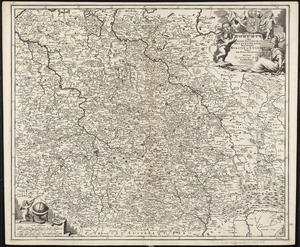
Regnum Bohemiae eique annexae provinciae ut Ducatus Silesiae, Marchionatus Moraviae et Lusatiae, vulgo die Erb-Länderen
2460.
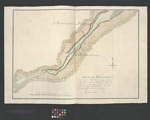
Sault aux Recollets
‹ Prev
Next ›
1
2
…
119
120
121
122
123
124
125
126
127
…
144
145
![Parish of St. Joseph [of Masquinonge]. Parish of the River du Loup](https://bpldcassets.blob.core.windows.net/derivatives/metadata/commonwealth-oai:8336n077h/image_thumbnail_300.jpg)