Toggle navigation
LMEC Home
Exhibitions
Georeferencing
Tools for Teachers
Collections
My Favorites
Sign Up / Log In
Search
Search the map portal
Map Collection
Map Collection
Map Sets
Search
Search
Search for
Search In
All Fields
Creator
Title
Subject
Place
Search All Digital Collections
Advanced Search
13680 Results
Filter your Search
Place
North and Central America
10,344
United States
8,475
Massachusetts
2,789
Suffolk (county)
1,677
Boston
1,633
Europe
1,415
Canada
950
New York
649
more
Place
»
Topic
Boston (Mass.)--Maps
747
City planning--Massachusetts--Boston--Maps
418
United States--History--Revolution, 1775-1783--Maps
329
United States--Maps
322
Real property--Massachusetts--Boston--Maps
254
Urban renewal--Massachusetts--Boston--Maps
254
Massachusetts--Maps
231
Insurance surveys
197
more
Topic
»
Date
Date range begin
–
Date range end
Current results range from
1482
to
2023
View distribution
Creator
United States. Hydrographic Office
597
Boston Redevelopment Authority
404
Des Barres, Joseph F. W. (Joseph Frederick Wallet), 1722-1824
247
Royal United Services Institute for Defence and Security Studies
160
Jefferys, Thomas, -1771
154
George, III, King of Great Britain, 1738-1820
152
George, IV, King of Great Britain, 1762-1830
151
O.H. Bailey & Co
148
more
Creator
»
Format
Maps/Atlases
13,499
Manuscripts
985
Prints
102
Books
49
Drawings/Illustrations
44
Photographs
15
Objects/Artifacts
13
Documents
7
more
Format
»
Georeferenced
Yes
979
No
12,701
Collection
Norman B. Leventhal Map & Education Center Collection
9,096
American Revolutionary War-Era Maps
3,305
Boston and New England Maps
2,915
Urban Maps
2,471
Maritime Charts and Atlases
1,169
William L. Clements Library Collection
910
Library of Congress Collection
618
Boston Redevelopment Authority Collection
475
more
Collection
»
Available to use
No known restrictions
10,246
Creative Commons license
1,678
Search Constraints
Sort by relevance
relevance
title
date (asc)
date (desc)
Number of results to display per page
20 per page
10
per page
20
per page
50
per page
100
per page
View results as:
grid view
map view
Search Results
2481.
City of Utica
2482.
The city of Vineland, New Jersey : 1885
2483.
City of Waltham, Massachusetts [assessors atlas]
2484.
City of Washington
2485.
City of White Plains, Westchester County, New York
2486.
The city of Worcester, Mass : 1878
2487.
Civil airways of the United States as designated in Civil Air Regulations - chapter 60
2488.
Civil War centennial
2489.
Civitas Londinum ano. dmi. circiter MDLX
2490.
Clappville
2491.
Clare, Mich : 1884
2492.
Clark County, Wis.
2493.
Clason's map of Los Angeles
2494.
Clayton, Delaware : 1885
2495.
Clearwater Manufacturing Company (Finishing Plant), Clearwater, S.C. [insurance map]
2496.
Clemens' map of Pennsylvania
2497.
Clemens' silent teacher, dissected map of the United States and of each state in counties
2498.
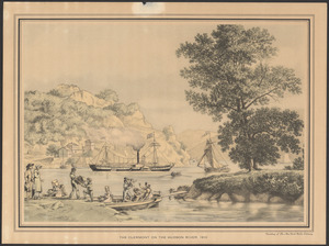
The Clermont on the Hudson River, 1810
2499.
[Cliftondale, Saugus and East Saugus, Massachusetts] : 1896
2500.
Climate zones for Eastern Asia
‹ Prev
Next ›
1
2
…
121
122
123
124
125
126
127
128
129
…
683
684


![City of Waltham, Massachusetts [assessors atlas]](https://bpldcassets.blob.core.windows.net/derivatives/images/commonwealth:cj82r8418/image_thumbnail_300.jpg)


![Clearwater Manufacturing Company (Finishing Plant), Clearwater, S.C. [insurance map]](https://bpldcassets.blob.core.windows.net/derivatives/images/commonwealth:2r36vc319/image_thumbnail_300.jpg)


![[Cliftondale, Saugus and East Saugus, Massachusetts]](https://bpldcassets.blob.core.windows.net/derivatives/images/commonwealth:x633fc53m/image_thumbnail_300.jpg)
