Toggle navigation
LMEC Home
Exhibitions
Georeferencing
Tools for Teachers
Collections
My Favorites
Sign Up / Log In
Search
Search the map portal
Map Collection
Map Collection
Map Sets
Search
Search
Search for
Search In
All Fields
Creator
Title
Subject
Place
Search All Digital Collections
Advanced Search
13680 Results
Filter your Search
Place
North and Central America
10,344
United States
8,475
Massachusetts
2,789
Suffolk (county)
1,677
Boston
1,633
Europe
1,415
Canada
950
New York
649
more
Place
»
Topic
Boston (Mass.)--Maps
747
City planning--Massachusetts--Boston--Maps
418
United States--History--Revolution, 1775-1783--Maps
329
United States--Maps
322
Real property--Massachusetts--Boston--Maps
254
Urban renewal--Massachusetts--Boston--Maps
254
Massachusetts--Maps
231
Insurance surveys
197
more
Topic
»
Date
Date range begin
–
Date range end
Current results range from
1482
to
2023
View distribution
Creator
United States. Hydrographic Office
597
Boston Redevelopment Authority
404
Des Barres, Joseph F. W. (Joseph Frederick Wallet), 1722-1824
247
Royal United Services Institute for Defence and Security Studies
160
Jefferys, Thomas, -1771
154
George, III, King of Great Britain, 1738-1820
152
George, IV, King of Great Britain, 1762-1830
151
O.H. Bailey & Co
148
more
Creator
»
Format
Maps/Atlases
13,499
Manuscripts
985
Prints
102
Books
49
Drawings/Illustrations
44
Photographs
15
Objects/Artifacts
13
Documents
7
more
Format
»
Georeferenced
Yes
979
No
12,701
Collection
Norman B. Leventhal Map & Education Center Collection
9,096
American Revolutionary War-Era Maps
3,305
Boston and New England Maps
2,915
Urban Maps
2,471
Maritime Charts and Atlases
1,169
William L. Clements Library Collection
910
Library of Congress Collection
618
Boston Redevelopment Authority Collection
475
more
Collection
»
Available to use
No known restrictions
10,246
Creative Commons license
1,678
Search Constraints
Sort by relevance
relevance
title
date (asc)
date (desc)
Number of results to display per page
20 per page
10
per page
20
per page
50
per page
100
per page
View results as:
grid view
map view
Search Results
5921.
Map of the middle states of America : comprehends New-York, New-Jersey, Pennsylvania, Delaware, and the territory N.W. of Ohio
5922.
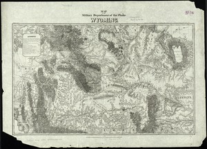
Map of the military Department of the Platte Wyoming
5923.
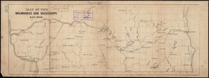
Map of the Milwaukee and Mississippi Rail-Road
5924.
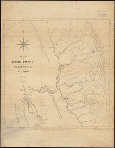
Map of the mining district of California
5925.
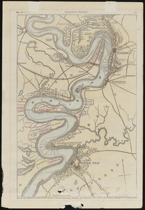
Map of the Mississippi, from Haine's Bluff to below Grand Gulf, showing the theatre of Gen. Grant's and Admiral Farragut's...
5926.
Map of the Mississippi River, from Cairo to the Gulf of Mexico, showing the position of the rebel fortifications at the mouth...
5927.
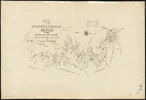
Map of the Monongahela River from Pittsburgh to Brownsville showing the location of coal works
5928.
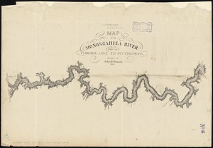
Map of the Monongahela River from the Virginia line to Pittsburgh
5929.
A map of the most inhabited part of New England : containing the provinces of Massachusets Bay and New Hampshire, with the...
5930.
A map of the most inhabited part of New England : containing the provinces of Massachusets Bay and New Hampshire, with the...
5931.
A map of the most inhabited part of New England : containing the provinces of Massachusets Bay and New Hampshire, with the...
5932.
A map of the most inhabited part of New England : containing the provinces of Massachusets Bay and New Hampshire, with the...
5933.
A map of the most inhabited part of New England : containing the provinces of Massachusets Bay and New Hampshire, with the...
5934.
A map of the most inhabited part of New England : containing the provinces of Massachusets Bay and New Hampshire, with the...
5935.
A map of the most inhabited part of New England : containing the provinces of Massachusets Bay and New Hampshire, with the...
5936.
A map of the most inhabited part of New England : containing the provinces of Massachusets Bay and New Hampshire, with the...
5937.
A map of the most inhabited part of New England containing the provinces of Massachusets Bay and New Hampshire with the...
5938.
A map of the most inhabited part of New England, containing the provinces of Massachusets Bay and New Hampshire, with the...
5939.
A map of the most inhabited part of Virginia containing the whole province of Maryland : with part of Pensilvania, New Jersey...
5940.
A map of the most inhabited part of Virginia containing the whole province of Maryland with part of Pensilvania, New Jersey and...
‹ Prev
Next ›
1
2
…
293
294
295
296
297
298
299
300
301
…
683
684


![A map of the most inhabited part of New England containing the provinces of Massachusets Bay and New Hampshire with the colonies of Connecticut and Rhode Island divided into counties and townships the w[h]ole composed from actual surveys and its situation adjusted by astronomical observations](https://bpldcassets.blob.core.windows.net/derivatives/images/commonwealth:6t053p316/image_thumbnail_300.jpg)


