Toggle navigation
LMEC Home
Exhibitions
Georeferencing
Tools for Teachers
Collections
My Favorites
Sign Up / Log In
Search
Search the map portal
Map Collection
Map Collection
Map Sets
Search
Search
Search for
Search In
All Fields
Creator
Title
Subject
Place
Search All Digital Collections
Advanced Search
13518 Results
Filter your Search
Place
North and Central America
10,232
United States
8,367
Massachusetts
2,778
Suffolk (county)
1,675
Boston
1,631
Europe
1,386
Canada
949
New York
640
more
Place
»
Topic
Boston (Mass.)--Maps
746
City planning--Massachusetts--Boston--Maps
418
United States--History--Revolution, 1775-1783--Maps
329
United States--Maps
321
Real property--Massachusetts--Boston--Maps
254
Urban renewal--Massachusetts--Boston--Maps
254
Massachusetts--Maps
230
Insurance surveys
197
more
Topic
»
Date
Date range begin
–
Date range end
Current results range from
1482
to
2023
View distribution
Creator
United States. Hydrographic Office
596
Boston Redevelopment Authority
404
Des Barres, Joseph F. W. (Joseph Frederick Wallet), 1722-1824
247
Royal United Services Institute for Defence and Security Studies
160
Jefferys, Thomas, -1771
154
George, III, King of Great Britain, 1738-1820
152
George, IV, King of Great Britain, 1762-1830
151
O.H. Bailey & Co
148
more
Creator
»
Format
Maps/Atlases
13,337
Manuscripts
985
Prints
102
Books
49
Drawings/Illustrations
44
Photographs
15
Objects/Artifacts
13
Documents
7
more
Format
»
Georeferenced
Yes
979
No
12,539
Collection
Norman B. Leventhal Map & Education Center Collection
9,022
American Revolutionary War-Era Maps
3,305
Boston and New England Maps
2,900
Urban Maps
2,425
Maritime Charts and Atlases
1,167
William L. Clements Library Collection
910
Library of Congress Collection
618
Boston Redevelopment Authority Collection
475
more
Collection
»
Available to use
No known restrictions
10,085
Creative Commons license
1,677
Search Constraints
Sort by relevance
relevance
title
date (asc)
date (desc)
Number of results to display per page
20 per page
10
per page
20
per page
50
per page
100
per page
View results as:
grid view
map view
Search Results
5761.
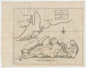
Map of the island of Martha's Vineyard with its dependencies
5762.
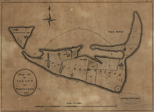
Map of the island of Nantucket
5763.
Map of the island of Nantucket, including Tuckernuck
5764.
A map of the island of Puerto Rico
5765.
A map of the island of St. Domingo
5766.
Map of the island of Tangerina and Wild Island
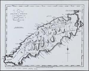
5767.
Map of the island of Tobago for the History of the West Indies
5768.
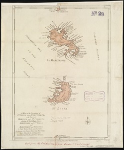
A map of the islands of St. Lucia and Martinique, with part of Dominica and St. Vincents : shewing the two passages between...
5769.
A map of the isle of Cuba : with the Bahama Islands, Gulf of Florida, and Windward Passage ; drawn from English and Spanish...
5770.
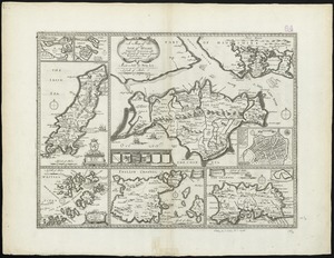
A map of the Isle of Wight Portsea Halinge, also the islands of Iarsey & Garnsey which are part of Hampshire
5771.
A map of the isthmus of Panama drawn from Spanish surveys
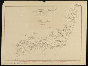
5772.
Map of the Japanese telegraph system
5773.
Map of the Jesuit missions in Huronia
5774.
A map of the King of Great Britains dominions in Germany, or, the Electorate of Brunswick-Luneburg, with its dependencies :...
5775.
A map of the kingdom of Scotland from the latest and best observations, for Mr. Tindal's Continuation of Mr. Rapin's History
5776.
A map of the lakes & Hudsons Bay
5777.
A map of the lakes & Hudsons Bay
5778.
A map of the land abt. Red Stone and Fort Pitt
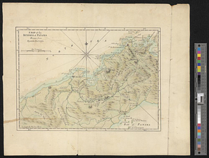
5779.
A Map of the lands ceded by the Cherokee Indians to the State of South-Carolina : at a congress held in May, A.D. 1777;...
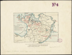
5780.
Map of the lands in Mississippi ceded by the Chickasaws to the United States in 1832 and 1834
‹ Prev
Next ›
1
2
…
285
286
287
288
289
290
291
292
293
…
675
676