Toggle navigation
LMEC Home
Exhibitions
Georeferencing
Tools for Teachers
Collections
My Favorites
Sign Up / Log In
Search
Search the map portal
Map Collection
Map Collection
Map Sets
Search
Search
Search for
Search In
All Fields
Creator
Title
Subject
Place
Search All Digital Collections
Advanced Search
2532 Results
My Search
Start Over
boston atlas
Remove constraint boston atlas
Filter your Search
Place
North and Central America
1,383
United States
842
Europe
464
Massachusetts
355
South America
191
Asia
190
Canada
187
Suffolk (county)
162
more
Place
»
Topic
Landowners--Massachusetts--Boston--Maps
115
Real property--Massachusetts--Boston--Maps
106
United States--Maps
85
Boston (Mass.)--Maps
64
Nautical charts--Early works to 1800
39
Buildings--Massachusetts--Boston--Maps
34
Elections--United States--Maps
34
Nova Scotia--Maps--Early works to 1800
33
more
Topic
»
Date
Date range begin
–
Date range end
Current results range from
1482
to
2023
View distribution
Creator
United States. Hydrographic Office
584
Des Barres, Joseph F. W. (Joseph Frederick Wallet), 1722-1824
116
Ptolemy, 2nd cent
100
Bromley, George Washington
86
Bromley, Walter Scott
84
Carey, Mathew, 1760-1839
72
Paullin, Charles Oscar, 1868 or 1869-1944
70
United States Exploring Expedition (1838-1842)
70
more
Creator
»
Format
Maps/Atlases
2,523
Books
34
Manuscripts
13
Prints
8
Drawings/Illustrations
1
Georeferenced
Yes
133
No
2,399
Collection
Norman B. Leventhal Map & Education Center Collection
2,431
Maritime Charts and Atlases
1,131
Boston and New England Maps
386
American Revolutionary War-Era Maps
285
Urban Maps
271
Massachusetts Real Estate Atlases
72
Mapping Boston Collection
61
Applied Geographics, Inc. Records
23
more
Collection
»
Available to use
No known restrictions
2,298
Creative Commons license
73
Search Constraints
Sort by relevance
relevance
title
date (asc)
date (desc)
Number of results to display per page
20 per page
10
per page
20
per page
50
per page
100
per page
View results as:
grid view
map view
Search Results
261.
South America
262.
Vereinigte Staaten von Nord-America
263.
New York
264.
Atlas of the city of Lawrence and the towns of Methuen, Andover and North Andover, Massachusetts
265.
Richards standard atlas of the city of Springfield and the town of Longmeadow, Massachusetts [plate 1]
266.
Richards standard atlas of the city of Springfield and the town of Longmeadow, Massachusetts [plate 10]
267.
Richards standard atlas of the city of Springfield and the town of Longmeadow, Massachusetts [plate 9]
268.
The 2100 project : an atlas for the Green New Deal
269.
Atlas of Middlesex County. Vol. 1. Cambridge, Somerville, Arlington, Belmont, Watertown, Everett, Malden, Medford, Newton,...
270.
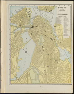
Boston
271.
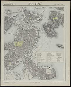
Boston
272.
Boston
273.
Boston
274.
Richards standard atlas of the city of Lynn and the towns of Swampscott, Saugus and Nahant, Massachusetts : from official...
275.
Johnson's new illustrated family atlas of the world, with physical geography, and with descriptions geographical, statistical,...
276.
Boston Harbour
277.
Boston Harbour : from the survey of A.S. Wadsworth, Esq., U.S.N. and the chart of Des Barres
278.
Boston Harbour : from the survey of A.S. Wadsworth Esq. U.S.N. and the chart of Des Barres
279.
Rand, McNally & Co.'s indexed atlas of the world map of Turkey in Europe, Roumania, Servia, Bulgaria, and Montenegro
280.
Property atlas of city of Lowell, northern district, Middlesex County, Massachusetts, showing the entire city complete in one...
‹ Prev
Next ›
1
2
…
10
11
12
13
14
15
16
17
18
…
126
127


![Richards standard atlas of the city of Springfield and the town of Longmeadow, Massachusetts [plate 1]](https://bpldcassets.blob.core.windows.net/derivatives/images/commonwealth:3f463814r/image_thumbnail_300.jpg)
![Richards standard atlas of the city of Springfield and the town of Longmeadow, Massachusetts [plate 10]](https://bpldcassets.blob.core.windows.net/derivatives/images/commonwealth:3f463818v/image_thumbnail_300.jpg)
![Richards standard atlas of the city of Springfield and the town of Longmeadow, Massachusetts [plate 9]](https://bpldcassets.blob.core.windows.net/derivatives/images/commonwealth:3f4638169/image_thumbnail_300.jpg)


![Johnson's new illustrated family atlas of the world, with physical geography, and with descriptions geographical, statistical, and historical, including the latest federal census, and the existing religious denominations in the world [frontispiece]](https://bpldcassets.blob.core.windows.net/derivatives/images/commonwealth:0r96fp61c/image_thumbnail_300.jpg)


