Toggle navigation
LMEC Home
Exhibitions
Georeferencing
Tools for Teachers
Collections
My Favorites
Sign Up / Log In
Search
Search the map portal
Map Collection
Map Collection
Map Sets
Search
Search
Search for
Search In
All Fields
Creator
Title
Subject
Place
Search All Digital Collections
Advanced Search
2888 Results
My Search
Start Over
atlas
Remove constraint atlas
Filter your Search
Place
North and Central America
1,673
United States
1,009
Europe
470
Massachusetts
359
Canada
271
South America
193
Asia
192
Suffolk (county)
165
more
Place
»
Topic
Landowners--Massachusetts--Boston--Maps
115
Real property--Massachusetts--Boston--Maps
106
United States--Maps
87
Boston (Mass.)--Maps
64
United States--History--French and Indian War, 1754-1763--Maps
63
Saint Lawrence River--Maps
41
Nautical charts--Early works to 1800
39
North America--Maps--Early works to 1800
36
more
Topic
»
Date
Date range begin
–
Date range end
Current results range from
1482
to
2023
View distribution
Creator
United States. Hydrographic Office
584
Des Barres, Joseph F. W. (Joseph Frederick Wallet), 1722-1824
118
Ptolemy, 2nd cent
100
Bromley, George Washington
99
Bromley, Walter Scott
97
G.W. Bromley & Co.
75
Carey, Mathew, 1760-1839
74
Paullin, Charles Oscar, 1868 or 1869-1944
70
more
Creator
»
Format
Maps/Atlases
2,872
Manuscripts
58
Books
37
Prints
8
Documents
5
Drawings/Illustrations
1
Georeferenced
Yes
142
No
2,746
Collection
Norman B. Leventhal Map & Education Center Collection
2,431
Maritime Charts and Atlases
1,169
American Revolutionary War-Era Maps
504
Boston and New England Maps
386
Urban Maps
271
Massachusetts Real Estate Atlases
144
William L. Clements Library Collection
92
Mapping Boston Collection
61
more
Collection
»
Available to use
No known restrictions
2,337
Creative Commons license
158
Search Constraints
Sort by relevance
relevance
title
date (asc)
date (desc)
Number of results to display per page
20 per page
10
per page
20
per page
50
per page
100
per page
View results as:
grid view
map view
Search Results
2421.
Asia recens summa cura delineata
2422.
The Cedres
2423.
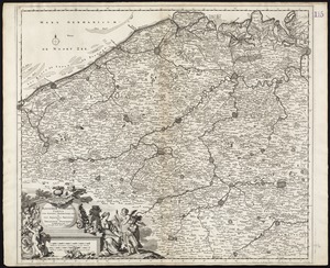
Comitatus Northantonensis vernacule Northampton Shire
2424.
Continuation of the Grande Riviere with the village of Fariole lying near Cape Torment on the north shore
2425.
Ducatus Meklenburgicus in quo sunt Ducatus Vandaliae et Meklenburgi Comitatus et Episcopatus Swerinensis Rostochiense et...
2426.
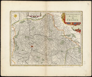
Gouvernement de l'Isle de France
2427.
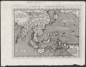
India Orientalis
2428.
Lotharingia ducatus noua descriptio
2429.
A map of Chili, Patagonia, La Plata and ye south part of Brasil
2430.
Marca d'Ancona olim Picenum
2431.
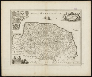
Nortfolcia : vernacule Norfolke
2432.
Novissima Flandriae comitatus tabula cum omnibus praefecturis, ect : et suis adjacentis provinciis
2433.
Palatinatus ad Rhenum
2434.
Parish of Batiscant. Parish of St. Pierre Becquet. Parish of Champlain. Parish of Gentilly
2435.
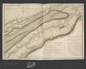
Parish of Berthier. Parish of St. François. Parish of St. Thomas
2436.
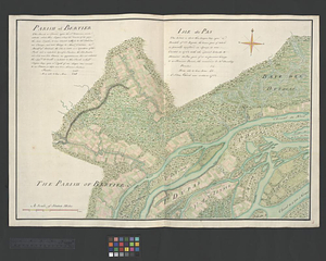
Parish of Bertier. Isle du Pas
2437.
Parish of Boucherville. Parish de la Magdelaine. Parish of La Prairie
2438.
Parish of Dechaillon or St. Jean. Parish of Grondines
2439.
Parish of Dechambeaux. Parish of Cape Sante. Parish of Lotbinière. Parish of St. Croix
2440.
Parish of Iamaska
‹ Prev
Next ›
1
2
…
118
119
120
121
122
123
124
125
126
…
144
145