Toggle navigation
LMEC Home
Exhibitions
Georeferencing
Tools for Teachers
Collections
My Favorites
Sign Up / Log In
Search
Search the map portal
Map Collection
Map Collection
Map Sets
Search
Search
Search for
Search In
All Fields
Creator
Title
Subject
Place
Search All Digital Collections
Advanced Search
13385 Results
Filter your Search
Place
North and Central America
10,111
United States
8,249
Massachusetts
2,691
Suffolk (county)
1,664
Boston
1,621
Europe
1,386
Canada
949
New York
640
more
Place
»
Topic
Boston (Mass.)--Maps
741
City planning--Massachusetts--Boston--Maps
418
United States--History--Revolution, 1775-1783--Maps
329
United States--Maps
315
Urban renewal--Massachusetts--Boston--Maps
254
Real property--Massachusetts--Boston--Maps
252
Massachusetts--Maps
219
Insurance surveys
197
more
Topic
»
Date
Date range begin
–
Date range end
Current results range from
1482
to
2023
View distribution
Creator
United States. Hydrographic Office
595
Boston Redevelopment Authority
403
Des Barres, Joseph F. W. (Joseph Frederick Wallet), 1722-1824
247
Royal United Services Institute for Defence and Security Studies
160
Jefferys, Thomas, -1771
154
George, III, King of Great Britain, 1738-1820
152
George, IV, King of Great Britain, 1762-1830
151
O.H. Bailey & Co
148
more
Creator
»
Format
Maps/Atlases
13,205
Manuscripts
985
Prints
102
Books
49
Drawings/Illustrations
44
Photographs
15
Objects/Artifacts
13
Documents
7
more
Format
»
Georeferenced
Yes
979
No
12,406
Collection
Norman B. Leventhal Map & Education Center Collection
8,891
American Revolutionary War-Era Maps
3,305
Boston and New England Maps
2,804
Urban Maps
2,397
Maritime Charts and Atlases
1,150
William L. Clements Library Collection
910
Library of Congress Collection
618
Boston Redevelopment Authority Collection
475
more
Collection
»
Available to use
No known restrictions
9,952
Creative Commons license
1,677
Search Constraints
Sort by relevance
relevance
title
date (asc)
date (desc)
Number of results to display per page
20 per page
10
per page
20
per page
50
per page
100
per page
View results as:
grid view
map view
Search Results
6221.
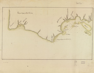
Map showing coast in the regions of Aguadilla, Añasco, and Mayagüez
6222.
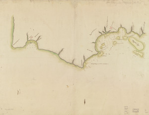
Map showing coast in the regions of Aguadilla, Añasco, and Mayagüez
6223.
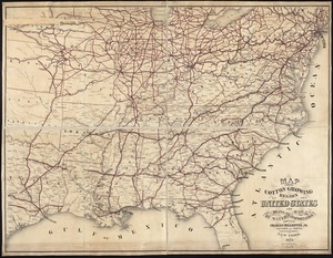
Map showing cotton growing region of the United States and means of transportation by water and rail
6224.
Map showing distribution of indian stocks and tribes, between 1710-1720
6225.
Map showing drives from the Walker-Gordon Laboratory, 203 Claredon St., Boston, to the Laboratory Farm in Wellesley
6226.
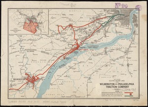
Map showing electric railway lines of the Wilmington and Philadelphia Traction Company
6227.
Map showing elevators in Manitoba, Saskatchewan and Alberta
6228.
[Map showing Fort Pitt, Fort Duquesne and Fort Mercer]
6229.
[Map showing Fort William Henry, Fort Carillon, Fort St Frederic, and the upper reaches of the Connecticut River]
6230.
Map showing horse rail roads and the surface steam roads with 104 stations in and around Boston : including 91 surface steam...
6231.
Map showing in five degrees of density the distribution of woodland within the territory of the United States, 1873
6232.
Map showing Indian reservations within the limits of the United States
6233.
Map showing Indian reservations within the limits of the United States, 1901
6234.
Map showing Indian reservations within the limits of the United States, 1903
6235.
Map showing Indian reservations within the limits of the United States, 1904
6236.
Map showing Indian reservations within the limits of the United States, 1905
6237.
Map showing Indian reservations within the limits of the United States, 1906
6238.
Map showing Japanese-Chinese warfre [sic] now in Shanghai
6239.
[Map showing Jonathan Carver's travels west of the Great Lakes.]
6240.
[Map showing Jonathan Carver's travels west of the Great Lakes.]
‹ Prev
Next ›
1
2
…
308
309
310
311
312
313
314
315
316
…
669
670


![[Map showing Fort Pitt, Fort Duquesne and Fort Mercer]](https://bpldcassets.blob.core.windows.net/derivatives/images/commonwealth:hx11z222w/image_thumbnail_300.jpg)
![[Map showing Fort William Henry, Fort Carillon, Fort St Frederic, and the upper reaches of the Connecticut River]](https://bpldcassets.blob.core.windows.net/derivatives/images/commonwealth:hx11z1735/image_thumbnail_300.jpg)


![Map showing Japanese-Chinese warfre [sic] now in Shanghai](https://bpldcassets.blob.core.windows.net/derivatives/images/commonwealth:9s161h819/image_thumbnail_300.jpg)
![[Map showing Jonathan Carver's travels west of the Great Lakes.]](https://bpldcassets.blob.core.windows.net/derivatives/images/commonwealth:hx11z299h/image_thumbnail_300.jpg)
![[Map showing Jonathan Carver's travels west of the Great Lakes.]](https://bpldcassets.blob.core.windows.net/derivatives/images/commonwealth:6108vw266/image_thumbnail_300.jpg)