Toggle navigation
LMEC Home
Exhibitions
Georeferencing
Tools for Teachers
Collections
My Favorites
Sign Up / Log In
Search
Search the map portal
Map Collection
Map Collection
Map Sets
Search
Search
Search for
Search In
All Fields
Creator
Title
Subject
Place
Search All Digital Collections
Advanced Search
13680 Results
Filter your Search
Place
North and Central America
10,344
United States
8,475
Massachusetts
2,789
Suffolk (county)
1,677
Boston
1,633
Europe
1,415
Canada
950
New York
649
more
Place
»
Topic
Boston (Mass.)--Maps
747
City planning--Massachusetts--Boston--Maps
418
United States--History--Revolution, 1775-1783--Maps
329
United States--Maps
322
Real property--Massachusetts--Boston--Maps
254
Urban renewal--Massachusetts--Boston--Maps
254
Massachusetts--Maps
231
Insurance surveys
197
more
Topic
»
Date
Date range begin
–
Date range end
Current results range from
1482
to
2023
View distribution
Creator
United States. Hydrographic Office
597
Boston Redevelopment Authority
404
Des Barres, Joseph F. W. (Joseph Frederick Wallet), 1722-1824
247
Royal United Services Institute for Defence and Security Studies
160
Jefferys, Thomas, -1771
154
George, III, King of Great Britain, 1738-1820
152
George, IV, King of Great Britain, 1762-1830
151
O.H. Bailey & Co
148
more
Creator
»
Format
Maps/Atlases
13,499
Manuscripts
985
Prints
102
Books
49
Drawings/Illustrations
44
Photographs
15
Objects/Artifacts
13
Documents
7
more
Format
»
Georeferenced
Yes
979
No
12,701
Collection
Norman B. Leventhal Map & Education Center Collection
9,096
American Revolutionary War-Era Maps
3,305
Boston and New England Maps
2,915
Urban Maps
2,471
Maritime Charts and Atlases
1,169
William L. Clements Library Collection
910
Library of Congress Collection
618
Boston Redevelopment Authority Collection
475
more
Collection
»
Available to use
No known restrictions
10,246
Creative Commons license
1,678
Search Constraints
Sort by relevance
relevance
title
date (asc)
date (desc)
Number of results to display per page
20 per page
10
per page
20
per page
50
per page
100
per page
View results as:
grid view
map view
Search Results
4841.
Map eighth division railway mail service
4842.
Map eleventh division railway mail service
4843.
A map exhibiting a general view of the roads and inland navigation of Pennsylvania, and part of the adjacent states :...
4844.
Map exhibiting the country between Lakes Michigan and Erie, and the contested boundary lines
4845.
Map exhibiting the Farmington & Hampshire & Hampden canals : together with the line of their proposed continuation through the...
4846.
A Map exhibiting the frontiers of Canada and the United States : intended to illustrate the operations of the British &...
4847.
Map, exhibiting the position of the several lines connected with the settlement of the Ohio boundary question
4848.
Map exhibiting the rail road, canal, lake and river routes from New York and Boston to the west, via Ogdensburgh, Buffalo and...
4849.
Map exhibiting the rail road routes leading from Boston, to Ogdensburg and Buffalo, N.Y
4850.
Map fifth division railway mail service
4851.
Map first division railway mail service
4852.
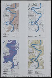
Map for area of critical environmental concern (ACEC) designation
4853.
Map for the interior travels through America : delineating the march of the army
4854.
Map for the interior travels through America, delineating the march of the army
4855.
Map fourth division railway mail service
4856.
Map from Albany to Crown Point
4857.
Map from the Pacific Ocean across the Rocky Mountain zone : to accompany report on the exploratory survey
4858.
Map illustrating the defence [sic] of Savannah, Ga. and the operations resulting in its capture by the army commanded by Maj....
4859.
Map illustrating the distribution of some of the more important trees in British Columbia
4860.
Map illustrating the military operations in front of Atlanta, Ga : from the passage of Peach Tree Creek, July 19th, 1864, to...
‹ Prev
Next ›
1
2
…
239
240
241
242
243
244
245
246
247
…
683
684


![Map illustrating the defence [sic] of Savannah, Ga. and the operations resulting in its capture by the army commanded by Maj. Genl. W.T. Sherman, Dec. 21st, 1864](https://bpldcassets.blob.core.windows.net/derivatives/images/commonwealth:4m90f544n/image_thumbnail_300.jpg)

