Toggle navigation
LMEC Home
Exhibitions
Georeferencing
Tools for Teachers
Collections
My Favorites
Sign Up / Log In
Search
Search the map portal
Map Collection
Map Collection
Map Sets
Search
Search
Search for
Search In
All Fields
Creator
Title
Subject
Place
Search All Digital Collections
Advanced Search
13419 Results
Filter your Search
Place
North and Central America
10,145
United States
8,283
Massachusetts
2,723
Suffolk (county)
1,664
Boston
1,621
Europe
1,386
Canada
949
New York
640
more
Place
»
Topic
Boston (Mass.)--Maps
742
City planning--Massachusetts--Boston--Maps
418
United States--History--Revolution, 1775-1783--Maps
329
United States--Maps
315
Urban renewal--Massachusetts--Boston--Maps
254
Real property--Massachusetts--Boston--Maps
252
Massachusetts--Maps
224
Insurance surveys
197
more
Topic
»
Date
Date range begin
–
Date range end
Current results range from
1482
to
2023
View distribution
Creator
United States. Hydrographic Office
595
Boston Redevelopment Authority
403
Des Barres, Joseph F. W. (Joseph Frederick Wallet), 1722-1824
247
Royal United Services Institute for Defence and Security Studies
160
Jefferys, Thomas, -1771
154
George, III, King of Great Britain, 1738-1820
152
George, IV, King of Great Britain, 1762-1830
151
O.H. Bailey & Co
148
more
Creator
»
Format
Maps/Atlases
13,239
Manuscripts
985
Prints
102
Books
49
Drawings/Illustrations
44
Photographs
15
Objects/Artifacts
13
Documents
7
more
Format
»
Georeferenced
Yes
979
No
12,440
Collection
Norman B. Leventhal Map & Education Center Collection
8,925
American Revolutionary War-Era Maps
3,305
Boston and New England Maps
2,838
Urban Maps
2,402
Maritime Charts and Atlases
1,150
William L. Clements Library Collection
910
Library of Congress Collection
618
Boston Redevelopment Authority Collection
475
more
Collection
»
Available to use
No known restrictions
9,986
Creative Commons license
1,677
Search Constraints
Sort by relevance
relevance
title
date (asc)
date (desc)
Number of results to display per page
20 per page
10
per page
20
per page
50
per page
100
per page
View results as:
grid view
map view
Search Results
13381.
The world's most populous countries
13382.
Worley's map of Dallas and suburbs
13383.
Worumbo Mfg. Co. (Woolen Mill), Lisbon Falls, Me. [insurance map]
13384.
Wrentham, Massachusetts, 1888
13385.
Wright's map of La Crosse
13386.
Wright's map of Milwaukee
13387.
Wyld's military map of the United States, the northern states, and the southern Confederate states : with the forts, harbours,...
13388.
Xingye dingxiang fang yangzhitu
13389.
Yaggy's geographical study [title page] : comprising physical, political, geological and astronomical geography
13390.
Yarmouth, Nova Scotia : 1889
13391.
Yellow Sea, west coast of Korea, A-San Anchorage : from a Japanese government survey in 1879
13392.
Yellowstone National Park : from surveys made under the direction of F.V. Hayden and other authorities
13393.
Yellowstone National Park, Big Horn Mountains and adjacent territory
13394.
Yeojido
13395.
Yggdrasill, the mundane tree
13396.
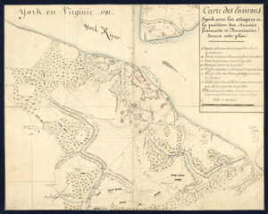
York en Virginie, 1781 : Carte des environs d'York avec les attaques à la position des Armées francaise et americaine devant...
13397.
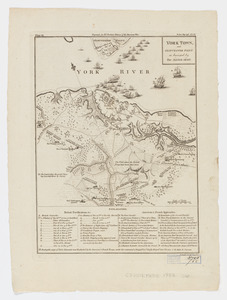
York Town, and Gloucester Point : as besieged by the Allied Army
13398.
Yorktown, Virginia, and the surrounding area, ca. 1781
13399.
Yosemite Valley
13400.
Ysla de Cuba
‹ Prev
Next ›
1
2
…
666
667
668
669
670
671


![Worumbo Mfg. Co. (Woolen Mill), Lisbon Falls, Me. [insurance map]](https://bpldcassets.blob.core.windows.net/derivatives/images/commonwealth:2r36vc23m/image_thumbnail_300.jpg)


![Yaggy's geographical study [title page]](https://bpldcassets.blob.core.windows.net/derivatives/images/commonwealth:3f463530h/image_thumbnail_300.jpg)