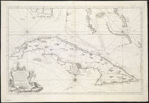
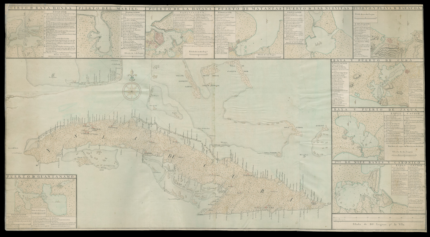
Ysla de Cuba
This map is also available in American Revolutionary Geographies Online (ARGO), a collections portal especially built for material relating to the American Revolutionary War Era. Visit ARGO to learn more about this item and explore the historical geography of North America in the late eighteenth century.
Item Information
- Title:
- Ysla de Cuba
- Title (alt.):
-
Isla de Cuba
- Date:
-
[1770]
- Format:
-
Maps/Atlases
Manuscripts
- Location:
- Newberry Library
- Collection (local):
-
Franco Novacco Map Collection
- Subjects:
-
Harbors--Cuba--Maps--Early works to 1800
Bays--Cuba--Maps--Early works to 1800
Nautical charts--Cuba--Early works to 1800
Manuscript maps--Early works to 1800
Cuba--Maps--Early works to 1800
- Places:
-
Cuba
- Extent:
- 1 ms. map : hand col. ; 430 x 831 mm. on sheet 580 x 1,075 mm.
- Terms of Use:
-
No known copyright restrictions.
Contact host institution for more information.
- Scale:
-
Scale [ca. 1:196,000]
- Language:
-
Spanish
- Table of Contents:
-
Puerto de Guantanamo
Puerto de Baya Honda
Puerto del Mariel
Puerto de la Havana
Puerto de Matanzas
Puerto de las Nuevitas
Puerto y playa de Baracoa
Baya y puerto de Cuba
Baya y puerto de Jagua
P[un]tos de Nipe Banes y Cabonico.
- Catalog Record:
-
https://i-share-nby.primo.exlibrisgroup.com/permalink/01CARLI_NBY/i5mcb2/alma991231678805867
- Notes:
-
Title from prominent lettering on the island.
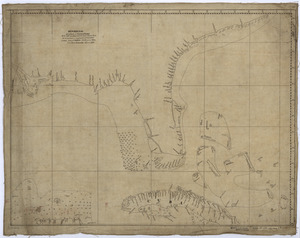
Relief shown pictorially and with hachures.
Include 10 insets (123 x 192 mm. and smaller) of harbors and bays at varying scales with separate location indexes.
Pen-and-ink and watercolor (green, brown, yellow, red).
- Notes (date):
-
This date is inferred.
- Call #:
-
Ayer MS map 321 (NLO)