Toggle navigation
LMEC Home
Exhibitions
Georeferencing
Tools for Teachers
Collections
My Favorites
Sign Up / Log In
Search
Search the map portal
Map Collection
Map Collection
Map Sets
Search
Search
Search for
Search In
All Fields
Creator
Title
Subject
Place
Search All Digital Collections
Advanced Search
10836 Results
My Search
Start Over
All Fields
americas
Remove constraint All Fields: americas
Filter your Search
Place
North and Central America
10,232
United States
8,361
Massachusetts
2,778
Suffolk (county)
1,673
Boston
1,629
Canada
936
New York
640
Middlesex (county)
438
more
Place
»
Topic
Boston (Mass.)--Maps
745
City planning--Massachusetts--Boston--Maps
418
United States--History--Revolution, 1775-1783--Maps
327
United States--Maps
319
Real property--Massachusetts--Boston--Maps
254
Urban renewal--Massachusetts--Boston--Maps
254
Massachusetts--Maps
230
Insurance surveys
194
more
Topic
»
Date
Date range begin
–
Date range end
Current results range from
1507
to
2023
View distribution
Creator
Boston Redevelopment Authority
404
United States. Hydrographic Office
365
Des Barres, Joseph F. W. (Joseph Frederick Wallet), 1722-1824
197
Jefferys, Thomas, -1771
150
George, III, King of Great Britain, 1738-1820
146
O.H. Bailey & Co
146
George, IV, King of Great Britain, 1762-1830
145
Royal United Services Institute for Defence and Security Studies
139
more
Creator
»
Format
Maps/Atlases
10,713
Manuscripts
916
Prints
60
Books
43
Drawings/Illustrations
43
Photographs
15
Objects/Artifacts
7
Posters
3
more
Format
»
Georeferenced
Yes
823
No
10,013
Collection
Norman B. Leventhal Map & Education Center Collection
6,600
American Revolutionary War-Era Maps
3,123
Boston and New England Maps
2,897
Urban Maps
2,277
William L. Clements Library Collection
892
Maritime Charts and Atlases
814
Library of Congress Collection
552
Boston Redevelopment Authority Collection
475
more
Collection
»
Available to use
No known restrictions
7,653
Creative Commons license
1,540
Search Constraints
Sort by relevance
relevance
title
date (asc)
date (desc)
Number of results to display per page
20 per page
10
per page
20
per page
50
per page
100
per page
View results as:
grid view
map view
Search Results
1741.
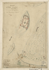
Plan of Fort Mifflin on Mud Island, with the batteries on Province Island
1742.
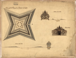
Plan of Fort Pownal at Penobscot built 1759
1743.
A plan of the attacks against Fort Miflin on Mud Island : which surrendered 16th, November 1777 to the Kings troops under the...
1744.
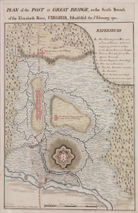
Plan of the post at Great Bridge, on the south branch of the Elizabeth River, Virginia : establish'd the 5th February 1781
1745.
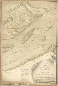
Plan of the river of Annapolis Royal in Nova Scotia
1746.
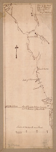
Plan of the route from St. Francis to Connecticut River
1747.
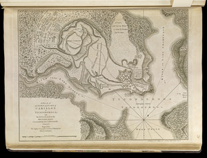
A plan of the town and Fort of Carillon at Ticonderoga : with the attack made by the British army commanded by Genl....
1748.
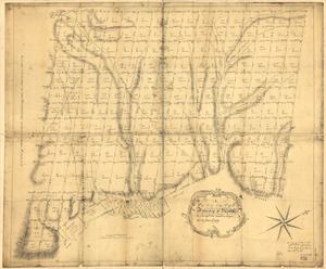
A plan of the township of Blenheim, as surveyed and divided in the year 1772
1749.
References to the plan of Gen. Gage's lines
1750.
Sketth [sic] of the Hessian attack on Fort Washington under General Knypehausen on the 16th November 1776
1751.
Ste. Lucie : d'après les plans levés par les Anglois lors qu'ils le possedoient
1752.
Ticonderoga as it was in 1759
1753.
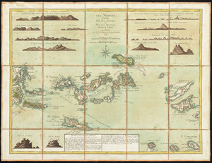
Les Vierges, levées par les Anglais, et par les Dannois : traduit de l'Anglais
1754.
Carta della Nuova Inghilterra, Nuova Iork, e Pensilvania
1755.
Map New England
1756.
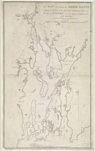
A map of part of Rhode Island shewing the positions of the American and British armies at the Siege of Newport, and the...
1757.
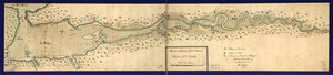
An authentic plan of the River St. Laurence from Sillery to the fall of Montmorenci, with the operations of the siege of Quebec...
1758.
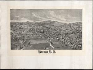
Newport, N.H. 1895
1759.
A map of the isle of Cuba : with the Bahama Islands, Gulf of Florida, and Windward Passage ; drawn from English and Spanish...
1760.
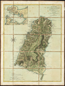
Dominica
‹ Prev
Next ›
1
2
…
84
85
86
87
88
89
90
91
92
…
541
542
![Sketth [sic] of the Hessian attack on Fort Washington under General Knypehausen on the 16th November 1776](https://bpldcassets.blob.core.windows.net/derivatives/images/commonwealth:q524n878n/image_thumbnail_300.jpg)