Toggle navigation
LMEC Home
Exhibitions
Georeferencing
Tools for Teachers
Collections
My Favorites
Sign Up / Log In
Search
Search the map portal
Map Collection
Map Collection
Map Sets
Search
Search
Search for
Search In
All Fields
Creator
Title
Subject
Place
Search All Digital Collections
Advanced Search
10951 Results
My Search
Start Over
All Fields
americas
Remove constraint All Fields: americas
Filter your Search
Place
North and Central America
10,344
United States
8,469
Massachusetts
2,789
Suffolk (county)
1,675
Boston
1,631
Canada
937
New York
649
Middlesex (county)
441
more
Place
»
Topic
Boston (Mass.)--Maps
746
City planning--Massachusetts--Boston--Maps
418
United States--History--Revolution, 1775-1783--Maps
327
United States--Maps
320
Real property--Massachusetts--Boston--Maps
254
Urban renewal--Massachusetts--Boston--Maps
254
Massachusetts--Maps
231
Insurance surveys
194
more
Topic
»
Date
Date range begin
–
Date range end
Current results range from
1507
to
2023
View distribution
Creator
Boston Redevelopment Authority
404
United States. Hydrographic Office
366
Des Barres, Joseph F. W. (Joseph Frederick Wallet), 1722-1824
197
Jefferys, Thomas, -1771
150
George, III, King of Great Britain, 1738-1820
146
O.H. Bailey & Co
146
George, IV, King of Great Britain, 1762-1830
145
Royal United Services Institute for Defence and Security Studies
139
more
Creator
»
Format
Maps/Atlases
10,828
Manuscripts
916
Prints
60
Books
43
Drawings/Illustrations
43
Photographs
15
Objects/Artifacts
7
Posters
3
more
Format
»
Georeferenced
Yes
823
No
10,128
Collection
Norman B. Leventhal Map & Education Center Collection
6,627
American Revolutionary War-Era Maps
3,123
Boston and New England Maps
2,912
Urban Maps
2,289
William L. Clements Library Collection
892
Maritime Charts and Atlases
816
Library of Congress Collection
552
Boston Redevelopment Authority Collection
475
more
Collection
»
Available to use
No known restrictions
7,767
Creative Commons license
1,541
Search Constraints
Sort by relevance
relevance
title
date (asc)
date (desc)
Number of results to display per page
20 per page
10
per page
20
per page
50
per page
100
per page
View results as:
grid view
map view
Search Results
10621.
Geological and topographical map of Crows Nest coal-fields, East Kootenay District, B.C. ; Geological sketch map of part of the...
10622.
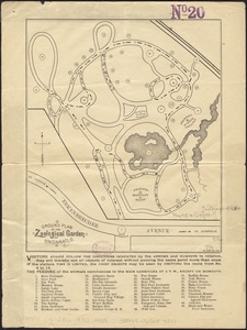
Ground plan of the Zoological Garden of Cincinnati, O
10623.
Hall and Elvans' subdivision of Meridian Hill, Washington County, D.C : Sept. 1867
10624.
Harbour and bay of Gaspee : Maul Bay
10625.
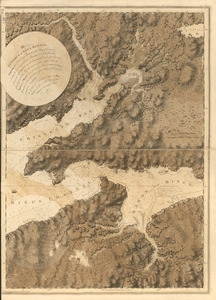
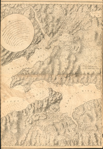
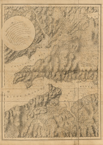
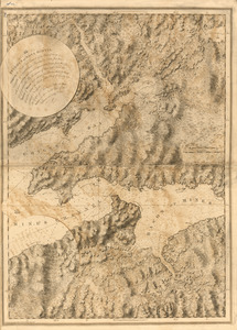
The isthmus of Nova Scotia
10626.
The isthmus of Nova Scotia
10627.
The isthmus of Nova Scotia
10628.
The isthmus of Nova Scotia
10629.
Lake George, Lake Champlain, the Adirondacks
10630.
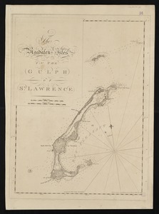
The Magdalen Isles in the Gulph of St. Lawrence
10631.
A map & chart of the bays harbours post roads and settlements in Passamaquoddy & Machias with the large island of Grand Manan
10632.
Map of Cayuga and Seneca counties, New York
10633.
Map of Cincinnati, Covington & Newport
10634.
Map of Cincinnati, Covington and Newport
10635.
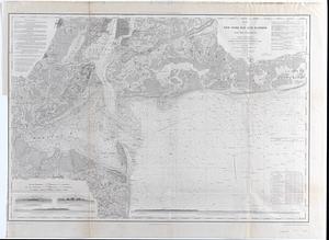
Map of New-York Bay and Harbor and the environs : Founded upon a trigonometrical survey under the direction of F.R. Hassler,...
10636.
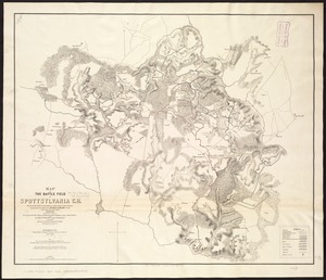
Map of the battle field of Spottsylvania C.H : showing the field of operations of the Army of the Potomac commanded by Maj....
10637.
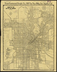
Map of the city of Los Angeles
10638.
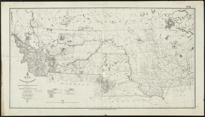
Map of the Department of Dakota including Minnesota, Dakota and Montana
10639.
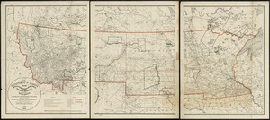
Map of the Department of Dakota including Minnesota, North Dakota, Montana, Yellowstone National Park, and that portion of...
10640.
Map of the eastern junc. Broad Sound Pier, & Pt. Shirley railroad : steamboat lines and connections : established for the...
‹ Prev
Next ›
1
2
…
528
529
530
531
532
533
534
535
536
…
547
548