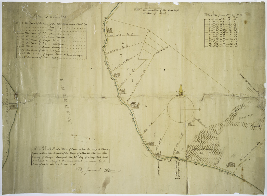
Map of a tract of land called the Nyack Patent lying within the limits of the town of New Utrecht in the County of Kings
Item Information
- Title:
- Map of a tract of land called the Nyack Patent lying within the limits of the town of New Utrecht in the County of Kings
- Creator:
- Lott, Jeremiah
- Name on Item:
-
surveyed the 26th day of May 1804 and protracted according to the magnetical meridian by a scale of eight chains to an inch by Jeremiah Lott.
- Date:
-
1804
- Format:
-
Maps/Atlases
Manuscripts
- Location:
- New York Public Library
- Collection (local):
-
Maps of New York City and State
- Subjects:
-
New Utrecht (New York, N.Y.)--Maps
Real property--New York (State)--Kings County--Maps
- Places:
-
Kings (county)
- Extent:
- 1 map : ms., col. ; 49 x 67 cm.
- Terms of Use:
-
No known copyright restrictions.
This work is licensed for use under a Creative Commons Attribution Non-Commercial Share Alike License (CC BY-NC-SA).

- Scale:
-
Scale [ca. 1:6,336]
- Language:
-
English
- Catalog Record:
-
https://digitalcollections.nypl.org/items/510d47da-eea2-a3d9-e040-e00a18064a99
- Notes:
-
Shows buildings and salt-meadow.
Covers lots numbered 1 to 11.
Pen and ink.