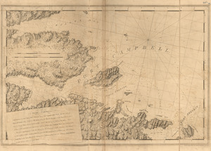
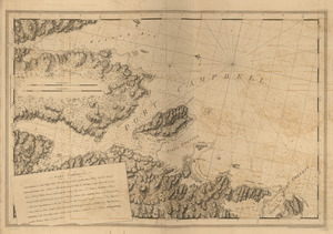
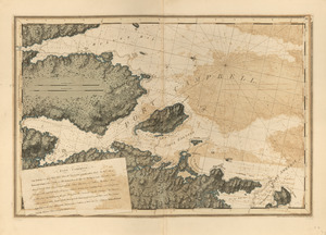
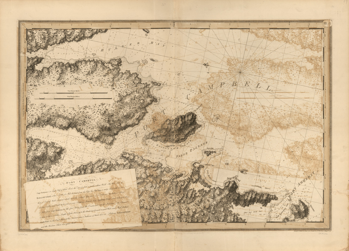
Port Campbell
This map is also available in American Revolutionary Geographies Online (ARGO), a collections portal especially built for material relating to the American Revolutionary War Era. Visit ARGO to learn more about this item and explore the historical geography of North America in the late eighteenth century.
Item Information
- Title:
- Port Campbell
- Publisher:
- Des Barres, Joseph F. W. (Joseph Frederick Wallet), 1722-1824
- Date:
-
1780
- Format:
-
Maps/Atlases
- Location:
- Library of Congress Geography and Map Division
- Collection (local):
-
Library of Congress Geography and Map Division
- Subjects:
-
Coasts--Nova Scotia--Maps
Shelburne Harbor (N.S.)--Maps
- Places:
-
Shelburne Harbour
- Extent:
- 1 map ; 70 x 104 cm
- Terms of Use:
-
No known copyright restrictions.
This work is licensed for use under a Creative Commons Attribution Non-Commercial Share Alike License (CC BY-NC-SA).

- Publisher:
-
[London] :
J.F.W. Des Barres
- Scale:
-
Scale [ca. 1:29,000]
- Language:
-
English
- Catalog Record:
-
https://lccn.loc.gov/75332511
- Notes:
-
State 7. Date of imprint advanced to February 1, 1780, rock- and tree-like symbols shaded, and outside border strengthened by alternately doubling the short cross lines.