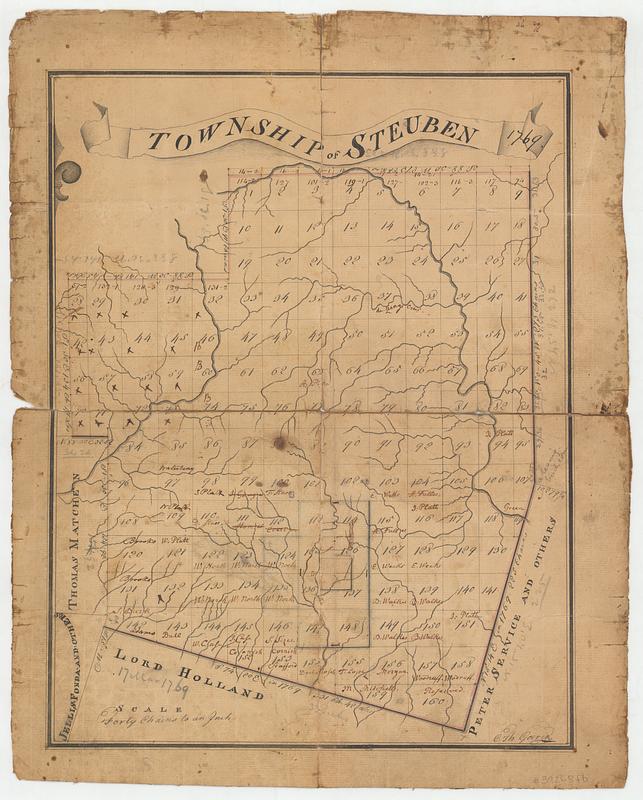
Township of Steuben 1769
This map is also available in American Revolutionary Geographies Online (ARGO), a collections portal especially built for material relating to the American Revolutionary War Era. Visit ARGO to learn more about this item and explore the historical geography of North America in the late eighteenth century.
Item Information
- Title:
- Township of Steuben 1769
- Contributor:
- Goerck, Casimir Th., -1798
- Name on Item:
-
C: Th: Goerck
- Date:
-
[ca. 1790]
- Format:
-
Maps/Atlases
- Genre:
-
Manuscript maps
- Location:
- MacLean Collection Map Library
- Collection (local):
-
MacLean Collection Map Library
- Subjects:
-
Steuben (N.Y.)--Maps
Real property--New York (State)--Steuben--Maps
Landowners--New York (State)--Steuben--Maps
- Places:
-
New YorkOneida (county)Steuben
- Extent:
- 1 ms map ; 381 x 293 mm
- Terms of Use:
-
Public Domain/No known restrictions on use. Contact host institution to download image.
Contact host institution for more information.
- Language:
-
English
- Identifier:
-
MC_34433
- Call #:
-
34433