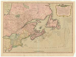
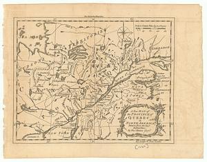
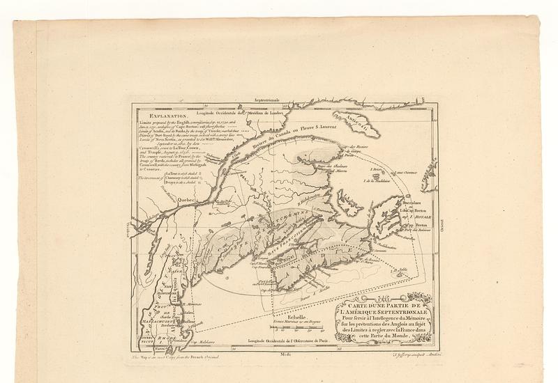
Carte d'une partie de l'Amérique Septentrionale : pour servir à l'intellegence du mémoire sur les prétentions des anglois au sujét des limites à regler avec la France dans cette partie du monde
This map is also available in American Revolutionary Geographies Online (ARGO), a collections portal especially built for material relating to the American Revolutionary War Era. Visit ARGO to learn more about this item and explore the historical geography of North America in the late eighteenth century.
Item Information
- Title:
- Carte d'une partie de l'Amérique Septentrionale : pour servir à l'intellegence du mémoire sur les prétentions des anglois au sujét des limites à regler avec la France dans cette partie du monde
- Publisher:
- Jefferys, Thomas, -1771
- Publisher:
- Sayer, Robert, 1725-1794
- Name on Item:
-
T. Jefferys sculpsit
- Date:
-
[1768]
- Format:
-
Maps/Atlases
- Location:
- MacLean Collection Map Library
- Collection (local):
-
MacLean Collection Map Library
- Subjects:
-
Indians of North America--Acadia--Maps--Early works to 1800
Québec (Province)--Maps--Early works to 1800
Maritime Provinces--Maps--Early works to 1800
- Places:
-
CanadaQuebec (province)
CanadaNova Scotia (province)
CanadaMaritime Provinces (area)
- Extent:
- 1 map ; 186 x 232 mm
- Terms of Use:
-
Public Domain/No known restrictions on use. Contact host institution to download image.
Contact host institution for more information.
- Publisher:
-
London :
Jefferys Sr., Thomas ; Sayer, Robert
- Edition:
- First state
- Language:
-
French
English
- Notes (date):
-
This date is inferred.
- Identifier:
-
MC_4344
- Call #:
-
4344