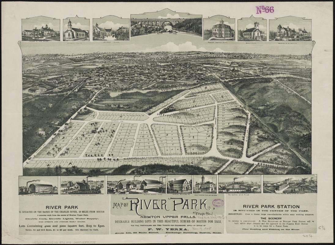
Map of River Park, Newton Upper Falls
Item Information
- Title:
- Map of River Park, Newton Upper Falls
- Date:
-
[1890?–1899?]
- Format:
-
Maps/Atlases
- Location:
-
Boston Public Library
Norman B. Leventhal Map & Education Center - Collection (local):
-
Norman B. Leventhal Map & Education Center Collection
- Subjects:
-
Real estate development--Massachusetts--Newton Upper Falls
Newton Upper Falls (Mass.)--Aerial views
- Places:
-
MassachusettsMiddlesex (county)NewtonNewton Upper Falls
- Extent:
- 1 view : col. ; 40 x 53 cm.
- Terms of Use:
-
No known copyright restrictions.
No known restrictions on use.
- Publisher:
-
S.l :
s.n.
- Scale:
-
Not drawn to scale.
- Language:
-
English
- Notes:
-
Bird's-eye view.
Includes ill.
- Identifier:
-
06_01_002141
- Call #:
-
G3764.N5:2N5A3 1890 .M3
- Barcode:
-
39999058991975


