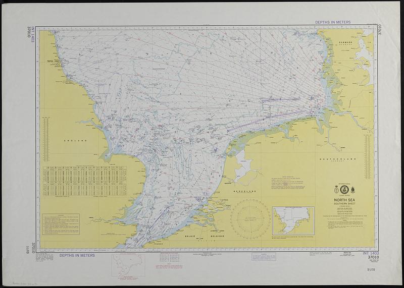
North Sea, southern sheet
Item Information
- Title:
- North Sea, southern sheet
- Cartographer:
- Netherlands. Hydrografisch Bureau
- Issuing body:
- United States. Defense Mapping Agency. Hydrographic Center
- Name on Item:
-
compiled by the Hydrographer of the Netherlands from information from the latest information to 1973
- Date:
-
1976
- Format:
-
Maps/Atlases
- Location:
-
Boston Public Library
Norman B. Leventhal Map & Education Center - Collection (local):
-
Applied Geographics, Inc. Records
- Subjects:
-
North Sea--Navigation
Nautical charts--North Sea
- Places:
-
North Sea
- Extent:
- 1 map : color ; 63 x 96 cm
- Terms of Use:
-
No known copyright restrictions.
No known restrictions on use.
- Publisher:
-
Washington, D.C. :
Published by the Defense Mapping Agency Hydrographic Center
- Edition:
- 15th ed., June 26, 1976.
- Scale:
-
Scale 1:750,000 (58°30')
- Projection:
- Mercator projection
- Language:
-
English
- Notes:
-
Relief shown by spot heights. Depths shown by isolines and soundings.
"Modified reproduction of INT Chart no. 1403, Aug. 1973 edition, originally published by the Netherlands."
Includes index to next larger scale charts, Decca chain coverage diagram, and table of tidal streams referred to HW at Dover.
"37010."
- Identifier:
-
06_01_019101
- Call #:
-
AppGeo Folder 33 no.15


