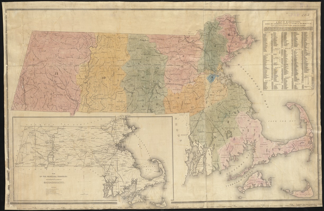
A map of Massachusetts, showing the congressional districts, as proposed by the Senate of 1852
Item Information
- Title:
- A map of Massachusetts, showing the congressional districts, as proposed by the Senate of 1852
- Creator:
- Walker, Amasa, 1799-1875
- Name on Item:
-
prepared under the direction of Amasa Walker, Secretary of the Commonwealth.
- Date:
-
[1852]
- Format:
-
Maps/Atlases
- Location:
-
Boston Public Library
Norman B. Leventhal Map & Education Center - Collection (local):
-
Norman B. Leventhal Map & Education Center Collection
- Subjects:
-
Massachusetts--Maps
Massachusetts--Administrative and political divisions--Maps
- Places:
-
Massachusetts
- Extent:
- 1 map : col. ; 57 x 93 cm.
- Terms of Use:
-
No known copyright restrictions.
No known restrictions on use.
- Publisher:
-
S.l :
s.n.
- Scale:
-
Scale not given.
- Language:
-
English
- Notes:
-
Includes inset: Plan of the prinicpal triangles in the trigonometrical survey of Massachusetts, and population table.
- Notes (date):
-
This date is inferred.
- Identifier:
-
06_01_002580
- Call #:
-
G3760 1852 .W3
- Barcode:
-
39999058995760