Birds eye view of the White Mountains
Item Information
- Title:
- Birds eye view of the White Mountains
- Description:
-
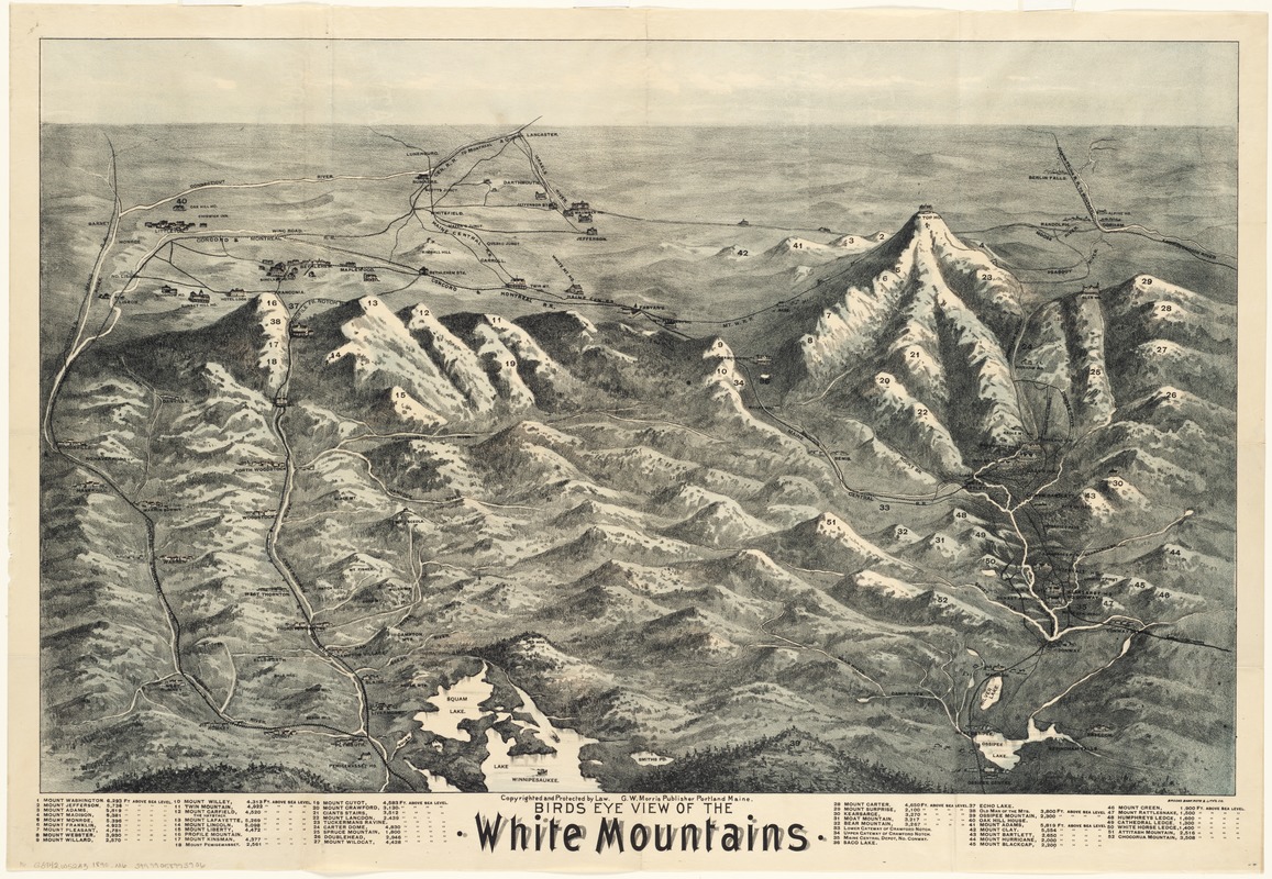
Looking north from Lake Winnipesaukee toward the White Mountains, this bird’s eye view provides an aerial perspective of the northern part of New Hampshire. Bird’s eye views, which were very popular for depicting cities and towns during the last half of the 19th century, were also used to advertise popular tourist destinations. In this rendition of the White Mountains, the most important peaks were emphasized with their elevations intentionally exaggerated. These mountains were numbered, with a legend listing names and elevations above sea level. Pictorial symbols identify hotels, resort communities, and railroads, providing further information for prospective tourists.
- Creator:
- Morris, G. W.
- Date:
-
[1890]
- Format:
-
Maps/Atlases
- Location:
-
Boston Public Library
Norman B. Leventhal Map & Education Center - Collection (local):
-
Norman B. Leventhal Map & Education Center Collection
- Subjects:
-
White Mountains (N.H. and Me.)--Aerial views
- Places:
-
New HampshireWhite Mountains
- Extent:
- 1 view ; 45 x 71 cm.
- Terms of Use:
-
No known copyright restrictions.
No known restrictions on use.
- Publisher:
-
Portland, Me :
G.W. Morris
- Scale:
-
Not drawn to scale.
- Language:
-
English
- Notes:
-
Includes index.
- Notes (date):
-
This date is inferred.
- Notes (exhibitions):
-
Exhibited: "Unconventional Maps: Exploring the Stories of Cartographic Curiosities" organized by the Norman B. Leventhal Map Center at the Boston Public Library, 2011-2012.
- Identifier:
-
06_01_002334
- Call #:
-
G3742.W52A3 1890 .M6
- Barcode:
-
39999058994102


