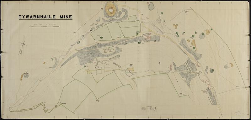
Tywarnhaile Mine
Item Information
- Title:
- Tywarnhaile Mine
- Cartographer:
- Clive, Philip
- Name on Item:
-
Philip Clive
- Date:
-
1945
- Format:
-
Maps/Atlases
- Genre:
-
Manuscript maps
- Location:
-
Boston Public Library
Norman B. Leventhal Map & Education Center - Collection (local):
-
Norman B. Leventhal Map & Education Center Collection
- Subjects:
-
St. Agnes (Cornwall, England)--Maps
Tywarnhayle Mine (England)--Maps
Mines and mineral resources--England--St. Agnes (Cornwall)--Maps
- Places:
-
EnglandCornwall (county)Saint Agnes
- Extent:
- 1 manuscript map : hand color ; 102 x 214 cm
- Terms of Use:
-
No known copyright restrictions.
No known restrictions on use.
- Scale:
-
Scale 1:600
- Language:
-
English
- Notes:
-
Relief shown by contours and spot heights.
Oriented with north to the upper right.
Shows trig stations, sub trig. stations, boundary traverse, roads, tracks, quarries, dumps, shafts (caved in), hedges, and fields.
Also shows buildings and structures.
- Identifier:
-
06_01_018845
- Call #:
-
G5754.S6555H1 1945 .C54
- Barcode:
-
39999085969176


