King Georges Group ; Aratica or Carlshoff Island
Item Information
- Title:
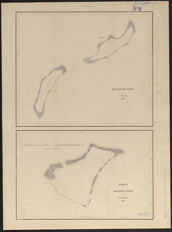
- King Georges Group ; Aratica or Carlshoff Island
- Surveyor:
- Wilkes, Charles, 1798-1877
- Engraver:
- Sherman & Smith
- Cartographer:
- United States Exploring Expedition (1838-1842)
- Name on Item:
-
by the U.S. Ex. Ex. 1839 ; eng. by Sherman & Smith
- Date:
-
[1840–1849]
- Format:
-
Maps/Atlases
- Genre:
-
Nautical charts
- Location:
-
Boston Public Library
Norman B. Leventhal Map & Education Center - Collection (local):
-
Norman B. Leventhal Map & Education Center Collection
- Subjects:
-
Tuamotu Archipelago (French Polynesia)--Maps
Îles du Roi Georges (French Polynesia)--Maps
Aratika (French Polynesia)--Maps
Nautical charts--French Polynesia--Aratika
Nautical charts--French Polynesia--Îles du Roi Georges
United States Exploring Expedition (1838-1842)
- Places:
-
French Polynesia (territory)King George Islands (area)
Aratika
- Extent:
- 2 maps on 1 sheet ; 59 x 38 cm
- Terms of Use:
-
No known copyright restrictions.
No known restrictions on use.
- Scale:
-
Scale approximately 1:145,000
Scale approximately 1:147,000
- Language:
-
English
- Table of Contents:
-
Kawahe or Vincennes Island, Paumoto Group
Raraka Island, Paumotu Group
- Notes:
-
Published in Narrative of the United States Exploring Expedition : during the years 1838, 1839, 1840, 1841, 1842.
Depths shown pictorially.
Includes coastal view of Aratica Island 4 miles distant.
- Notes (date):
-
This date is inferred.
- Identifier:
-
06_01_017637
- Call #:
-
G9631.P5 1840 .U552
- Barcode:
-
39999085960928


