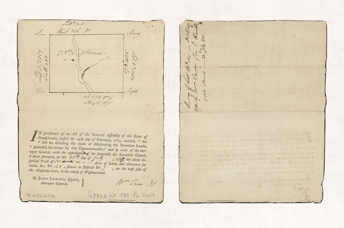
Survey of lot no. 121 in district no.7
This map is also available in American Revolutionary Geographies Online (ARGO), a collections portal especially built for material relating to the American Revolutionary War Era. Visit ARGO to learn more about this item and explore the historical geography of North America in the late eighteenth century.
Item Information
- Title:
- Survey of lot no. 121 in district no.7
- Creator:
- Power, Wm. (William), active 18th century
- Name on Item:
-
by Wm. Power for E. Hand, 500 acres, 20th July 1785
- Date:
-
[1785]
- Format:
-
Maps/Atlases
Manuscripts
- Location:
- Library of Congress Geography and Map Division
- Collection (local):
-
Library of Congress Collection
- Subjects:
-
Westmoreland County (Pa.)--Maps, Manuscript--Early works to 1800
- Places:
-
Westmoreland (county)
- Extent:
- 1 manuscript map on sheet 21 x 17 cm.
- Terms of Use:
-
No known copyright restrictions.
This work is licensed for use under a Creative Commons Attribution Non-Commercial Share Alike License (CC BY-NC-SA).

- Scale:
-
Scale not given
- Language:
-
English
- Catalog Record:
-
https://lccn.loc.gov/76692292
- Notes:
-
Title from verso.
Manuscript; pen and ink on printed form.
On lower half of sheet: In pursuance of an Act of the General Assembly of the State of Pennsylvania ... and by order of the Surveyor General ... I have surveyed ... 500 acres of land ... on the west side of the Allegheny River, in the county of Westmoreland. [Signed] Wm. Power D.S.
- Notes (date):
-
This date is inferred.
- Notes (citation):
-
LC Maps of North America, 1750-1789, 1305
- Identifier:
-
ar130500z


