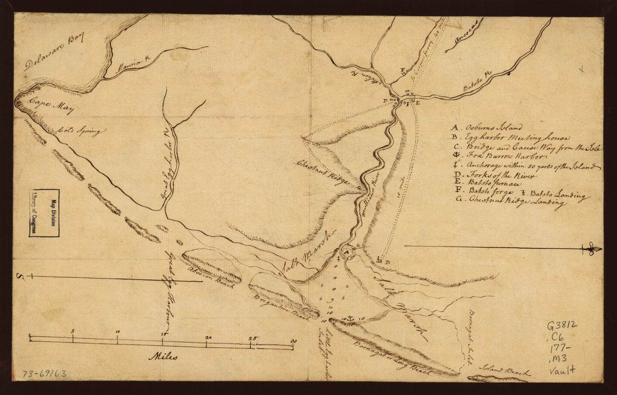
Map of the coast of New Jersey from Barnegat Inlet to Cape May
This map is also available in American Revolutionary Geographies Online (ARGO), a collections portal especially built for material relating to the American Revolutionary War Era. Visit ARGO to learn more about this item and explore the historical geography of North America in the late eighteenth century.
Item Information
- Title:
- Map of the coast of New Jersey from Barnegat Inlet to Cape May
- Title (alt.):
-
New Jersey from Barnegat Inlet to Cape May
- Date:
-
[1770?–1779?]
- Format:
-
Maps/Atlases
Manuscripts
- Location:
- Library of Congress Geography and Map Division
- Collection (local):
-
Library of Congress Collection
- Subjects:
-
Coasts--New Jersey--Maps--Early works to 1800
Batsto Region (N.J.)--Maps, Manuscript--Early works to 1800
- Places:
-
New Jersey
- Extent:
- 1 manuscript map 21 x 34 cm.
- Terms of Use:
-
No known copyright restrictions.
This work is licensed for use under a Creative Commons Attribution Non-Commercial Share Alike License (CC BY-NC-SA).

- Scale:
-
Scale ca. 1:32,000
- Language:
-
English
- Catalog Record:
-
https://lccn.loc.gov/73691635
- Notes:
-
Manuscript, pen-and-ink.
Oriented with north to the right.
Relief shown by shading. Soundings shown in fathoms.
Shows the coast and the Mullica River inland to the site of the "Batsto forge."
Indexed for points of interest.
- Notes (citation):
-
LC Maps of North America, 1750-1789, 1264
- Identifier:
-
ct000078z


