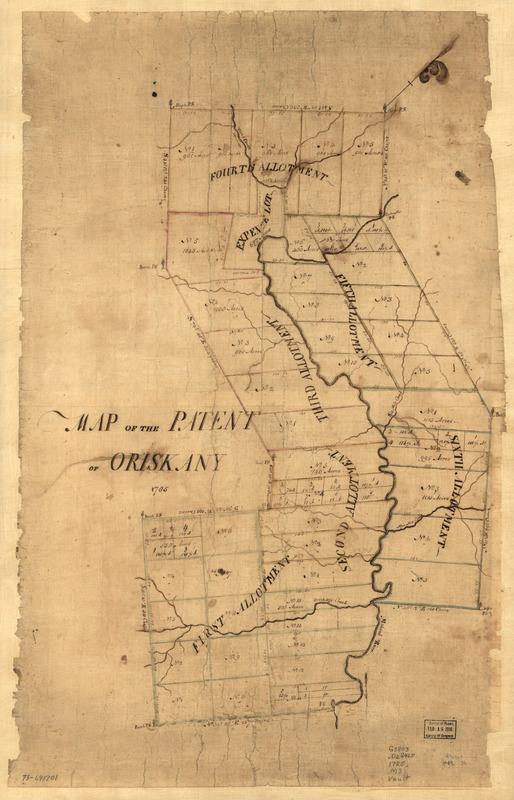
Map of the patent of Oriskany
This map is also available in American Revolutionary Geographies Online (ARGO), a collections portal especially built for material relating to the American Revolutionary War Era. Visit ARGO to learn more about this item and explore the historical geography of North America in the late eighteenth century.
Item Information
- Title:
- Map of the patent of Oriskany
- Title (alt.):
-
Patent of Oriskany
- Date:
-
1785
- Format:
-
Maps/Atlases
Manuscripts
- Location:
- Library of Congress Geography and Map Division
- Collection (local):
-
Library of Congress Collection
- Subjects:
-
Land grants--New York (State)--Oneida County--Maps--Early works to 1800
Oneida County (N.Y.)--Maps, Manuscript--Early works to 1800
- Places:
-
Oneida (county)
- Extent:
- 1 manuscript map : hand color on sheet 74 x 47 cm.
- Terms of Use:
-
No known copyright restrictions.
This work is licensed for use under a Creative Commons Attribution Non-Commercial Share Alike License (CC BY-NC-SA).

- Scale:
-
Scale ca. 1:32,000
- Language:
-
English
- Catalog Record:
-
https://lccn.loc.gov/73691701
- Notes:
-
Manuscript, pen-and-ink and watercolor.
Oriented with north toward the upper right.
Cadastral map.
Shows land allotments, with subdivisions, adjacent to the Mohawk River from Oriskany to Rome.
- Notes (citation):
-
LC Maps of North America, 1750-1789, 1082
- Identifier:
-
ar108200


