Atlas of the city of Boston : city proper : plate P
Item Information
- Title:
- Atlas of the city of Boston : city proper : plate P
- Description:
-
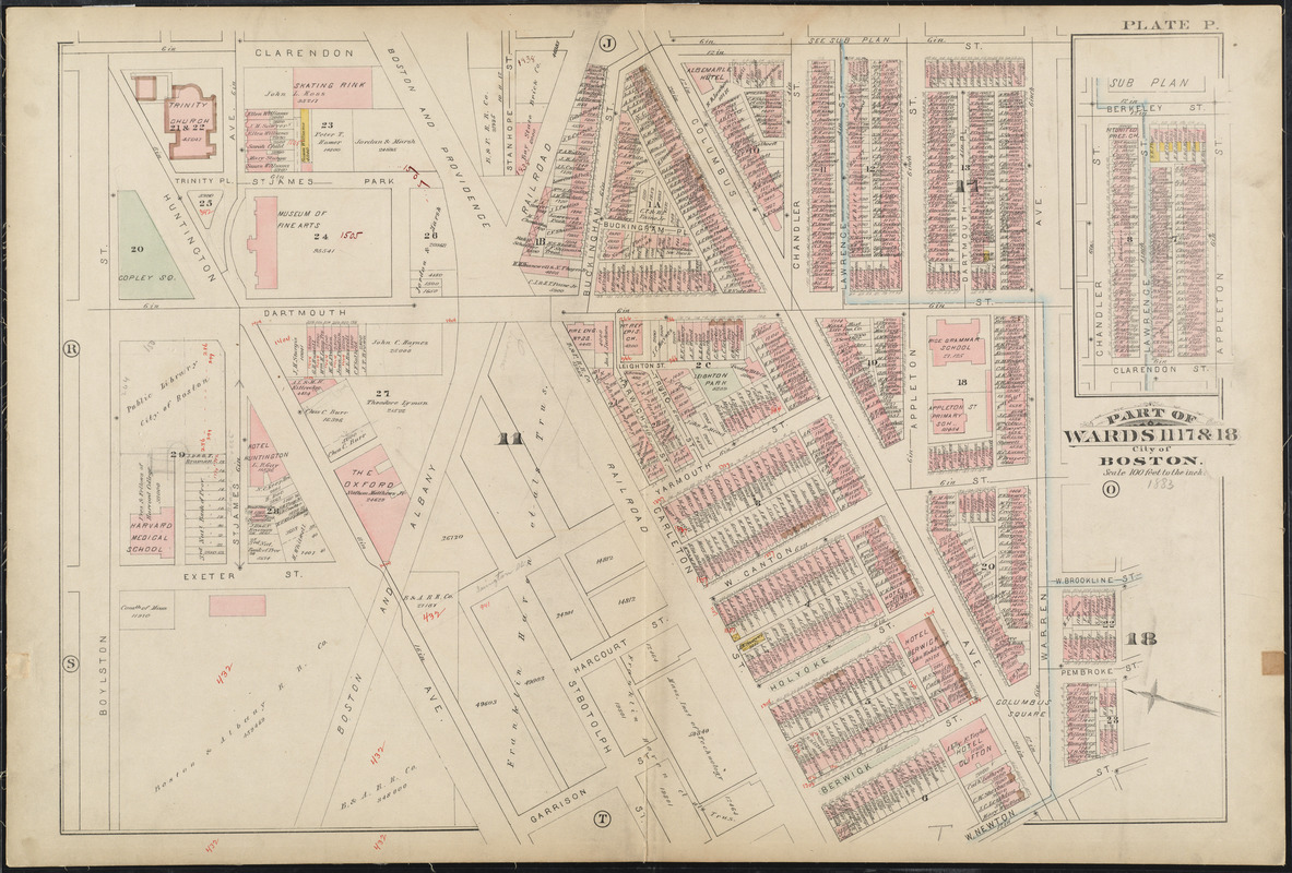
As seen in this 1883 map, Copley Square was once a large triangle. The unique shape of the Square was a result of its location at the junction of the older South End’s and the newer Back Bay’s street grids. Huntington Avenue met Boylston Street at a 45 degree angle, creating a number of triangular spaces in the region. Traffic passed through the square on Huntington Avenue until the late 1960s; however, in the 1980s the area was redesigned to appear as it does today, complete with a large green space for all to enjoy.
- Creator:
- G.W. Bromley & Co.
- Date:
-
1883
- Format:
-
Maps/Atlases
- Location:
-
Boston Public Library
Norman B. Leventhal Map & Education Center - Collection (local):
-
Norman B. Leventhal Map & Education Center Collection
- Subjects:
-
Boston (Mass.)--Maps
Real property--Massachusetts--Boston--Maps
Landowners--Massachusetts--Boston--Maps
Back Bay (Boston, Mass.)--Maps
- Places:
-
MassachusettsSuffolk (county)BostonBack Bay
- Extent:
- 1 map : color ; 51 x 77 cm
- Terms of Use:
-
No known copyright restrictions.
No known restrictions on use.
- Publisher:
-
Philadelphia :
G.W. Bromley & Co.
- Scale:
-
Scale 1:1,200
- Language:
-
English
- Notes (exhibitions):
-
Exhibited: "Boston in the Gilded Age: Mapping Public Places" organized by the Norman B. Leventhal Map Center at the Boston Public Library, 2012-2013.
- Identifier:
-
06_01_012721
- Call #:
-
G1234.B6 B7 1883 v.1
- Barcode:
-
39999059010908
![[Plan of boundary lines in Roxbury and the City of Boston]](https://bpldcassets.blob.core.windows.net/derivatives/images/commonwealth:1257bb127/image_thumbnail_300.jpg)

![Plan of lands on the Back Bay belonging to the Boston Water Power Co., the Commonwealth and other parthies [i.e. parties], showing the system of streets, grades and sewers as laid out and recommended by the Back Bay Commissioners](https://bpldcassets.blob.core.windows.net/derivatives/images/commonwealth:1257bb305/image_thumbnail_300.jpg)

