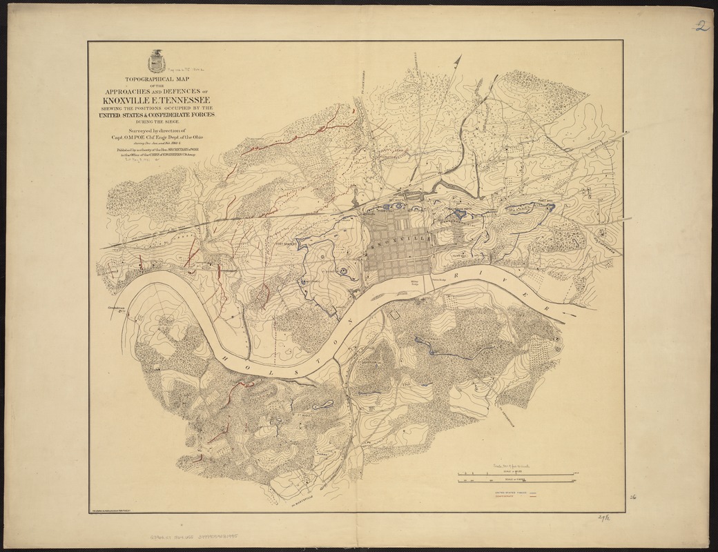
Topographical map of the approaches and defences of Knoxville, E. Tennessee, shewing the positions occupied by the United States & Confederate forces during the siege
Item Information
- Title:
- Topographical map of the approaches and defences of Knoxville, E. Tennessee, shewing the positions occupied by the United States & Confederate forces during the siege
- Creator:
- United States. Army. Office of the Chief of Engineers
- Name on Item:
-
surveyed by direction of Capt. O.M. Poe, chf. engr., Dept. of the Ohio, during Dec., Jan., and Feb. 1863-4 ; published by authority of the Hon. Secretary of War in the Office of the Chief of Engineers, U.S. Army.
- Date:
-
[1864]
- Format:
-
Maps/Atlases
- Location:
-
Boston Public Library
Norman B. Leventhal Map & Education Center - Collection (local):
-
Norman B. Leventhal Map & Education Center Collection
- Subjects:
-
Knoxville (Tenn.)--History--19th century--Maps
Knoxville (Tenn.)--Defenses--Maps
- Places:
-
TennesseeKnox (county)Knoxville
- Extent:
- 1 map : col. ; 66 x 75 cm.
- Terms of Use:
-
No known copyright restrictions.
No known restrictions on use.
- Publisher:
-
S.l :
s.n.
- Scale:
-
Scale [ca. 1:9900].
- Language:
-
English
- Notes:
-
Annotated in blue ink to show Union lines, in red ink to show Confederate lines, and blue and red ink to show lines of Union forces captured by the Rebels.
Relief shown in hachures, contours, and spot heights.
Hand colored.
- Notes (date):
-
This date is inferred.
- Identifier:
-
06_01_007504
- Call #:
-
G3964.K7 1864 .U55
- Barcode:
-
39999059031995


