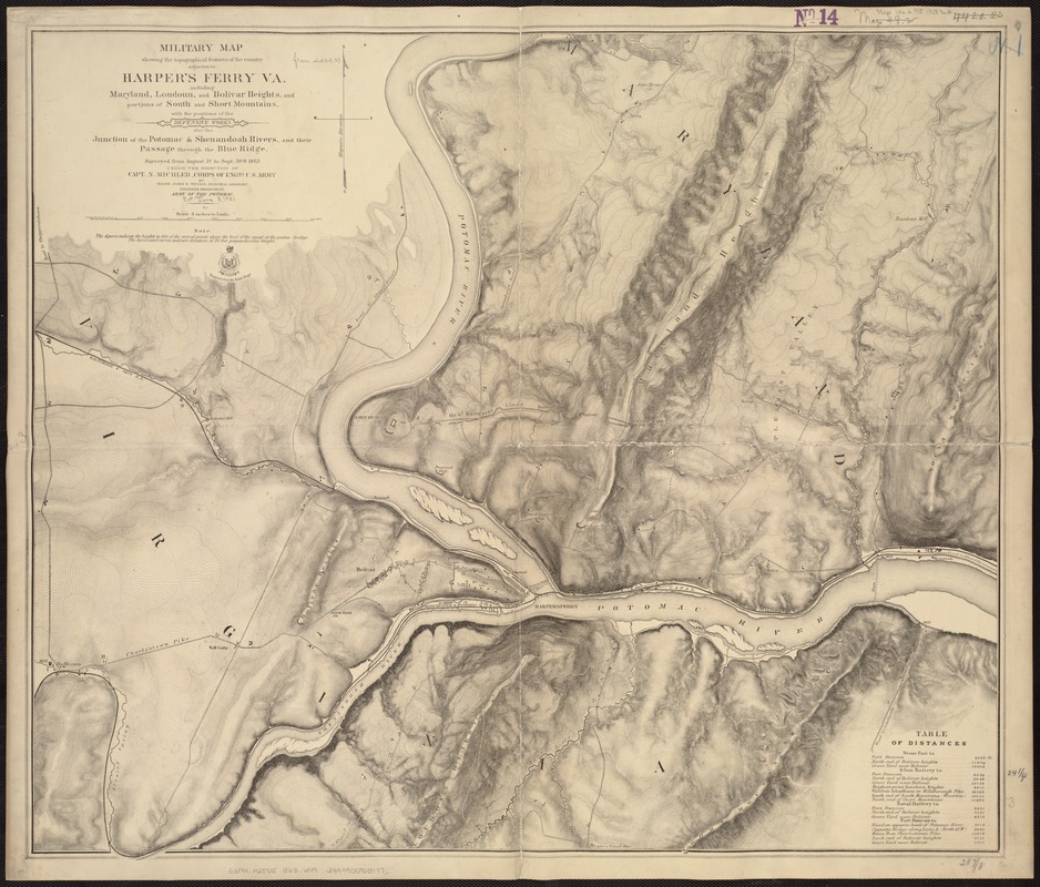
Military map showing the topographical features of the country adjacent to Harper's Ferry, Va : including Maryland, Loudoun, and Bolivar Heights, and portions of South and Short Mountains, with the positions of the defensive works
Item Information
- Title:
- Military map showing the topographical features of the country adjacent to Harper's Ferry, Va : including Maryland, Loudoun, and Bolivar Heights, and portions of South and Short Mountains, with the positions of the defensive works
- Creator:
- Weyss, J. E.
- Name on Item:
-
Surveyed from August 3d to Sept. 30th, 1863 under the direction of Capt. N. Michler ... by Major John E. Weyss.
- Date:
-
[1863?]
- Format:
-
Maps/Atlases
- Location:
-
Boston Public Library
Norman B. Leventhal Map & Education Center - Collection (local):
-
Norman B. Leventhal Map & Education Center Collection
- Subjects:
-
Harpers Ferry (W. Va.)--History--19th century--Maps
United States--History--Civil War, 1861-1865--Maps
August 1863–September 1863
- Places:
-
West VirginiaJefferson (county)Harpers Ferry
- Extent:
- 1 map : b&w ; 62 x 74 cm., on sheet 70 x 80 cm.
- Terms of Use:
-
No known copyright restrictions.
No known restrictions on use.
- Publisher:
-
Washington, D.C.? :
Engineer Dept., Army of the Potomac
- Scale:
-
Scale 1:15,840.
- Language:
-
English
- Notes:
-
Relief shown by hachures and form lines.
Engraved in the Engr. Dept.
- Identifier:
-
06_01_007421
- Call #:
-
G3894.H25S5 1863 .W49
- Barcode:
-
39999059031177


