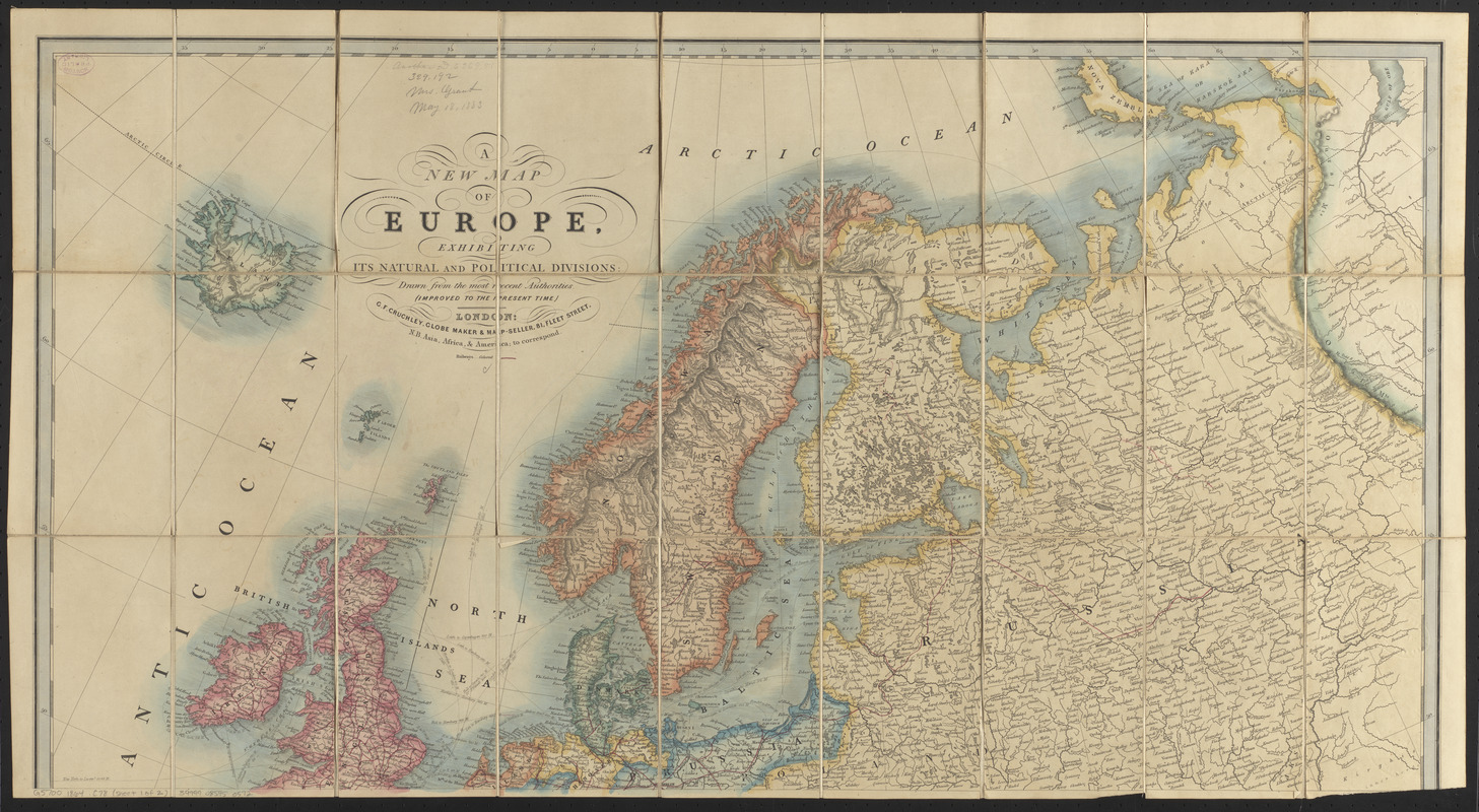
A new map of Europe, exhibiting its natural and political divisions : drawn from the most recent authorities (improves to the present time)

Item Information
- Title:
- A new map of Europe, exhibiting its natural and political divisions : drawn from the most recent authorities (improves to the present time)
- Title (alt.):
-
Tourist map of Europe shewing the railways and steam connections
- Publisher:
- Cruchley, G. F.
- Date:
-
[1864?]
- Format:
-
Maps/Atlases
- Location:
-
Boston Public Library
Norman B. Leventhal Map & Education Center - Collection (local):
-
Norman B. Leventhal Map & Education Center Collection
- Subjects:
-
Railroads--Europe--Maps
Europe--Maps
- Places:
-
Europe
Europe
- Extent:
- 1 map on 2 sheets : hand color ; 88 x 84 cm, on sheets 48 x 88 cm
- Terms of Use:
-
No known copyright restrictions.
No known restrictions on use.
- Publisher:
-
London :
G.F. Cruchley, globe maker & map-seller, 81, Fleet Street
- Scale:
-
Scale approximately 1:5,800,000
- Language:
-
English
- Notes:
-
Relief shown by hachures.
- Identifier:
-
06_01_016666A
06_01_016666B
- Call #:
-
G5700 1864 .C78
- Barcode:
-
39999085950572


