Homeland security & critical infrastructure protection : Boston pilot preparedness project
Item Information
- Title:
- Homeland security & critical infrastructure protection : Boston pilot preparedness project
- Description:
-
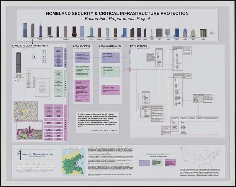
Explanation of a pilot project to build detailed geospatial data sets of municipalities in the Boston metropolitan area. Diagram outlines critical facility information to collect, data capture, data maintenance and data storage.
- Creator:
- Applied Geographics, Inc.
- Name on Item:
-
Applied Geographics, Inc.
- Date:
-
[2002]
- Format:
-
Posters
- Location:
-
Boston Public Library
Norman B. Leventhal Map & Education Center - Collection (local):
-
Norman B. Leventhal Map & Education Center Collection
- Subjects:
-
Database management--Charts, diagrams, etc.
Database design--Charts, diagrams, etc.
Geospatial data--Collection and preservation
Buildings--Massachusetts--Boston
Boston Metropolitan Area (Mass.)
- Places:
-
MassachusettsSuffolk (county)Boston
- Extent:
- 1 sheet : color, backed on plastic ; 90 x 114 cm
- Terms of Use:
-
No known copyright restrictions.
No known restrictions on use.
- Publisher:
-
[Boston] :
[Applied Geographics, Inc.]
- Language:
-
English
- Table of Contents:
-
Section no. 1. North Sea to La Fére
Section no 2. La Fére to Verdun
Section no. 3. Verdun to Colmar
- Notes:
-
Includes illustrations of buildings, maps, diagrams and text.
- Notes (date):
-
This date is inferred.
- Notes (exhibitions):
-
Exhibited: "Processing place: how computers and cartographers redrew our world," organized by Norman B. Leventhal Map & Education Center at the Boston Public Library, 2024-2025
- Identifier:
-
06_01_019457
- Call #:
-
AppGeo Folder 4 no. 14
- Barcode:
-
30000008056764


