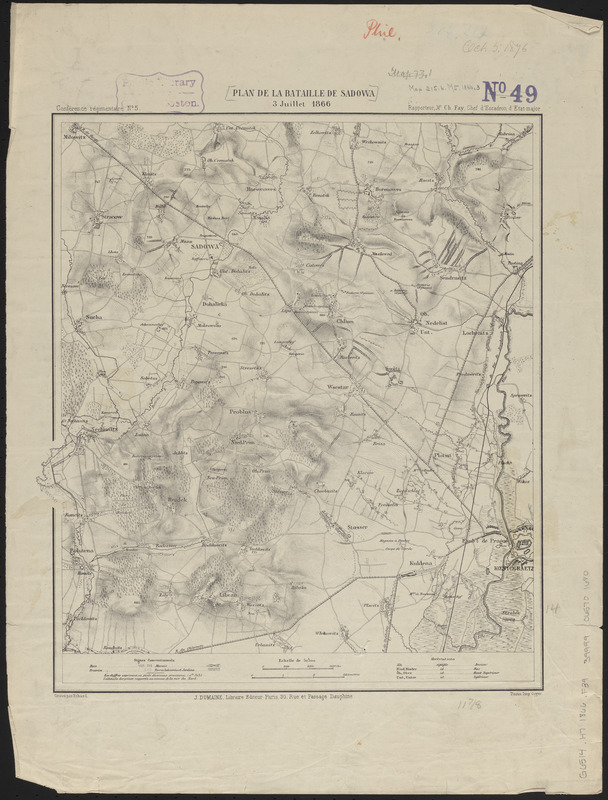
Plan de la bataille de Sadowa
Item Information
- Title:
- Plan de la bataille de Sadowa
- Cartographer:
- Fay, Charles Alexandre, 1827-1903
- Printer:
- Goyer
- Publisher:
- Librairie militaire de J. Dumaine
- Name on Item:
-
rapporteur, Mr. Ch. Fay, Chef d'Escadron d'État-major ; gravé par Erhard
- Date:
-
[1866]
- Format:
-
Maps/Atlases
- Location:
-
Boston Public Library
Norman B. Leventhal Map & Education Center - Collection (local):
-
Norman B. Leventhal Map & Education Center Collection
- Subjects:
-
Königgrätz, Battle of, Sadová, Czech Republic, 1866
Austro-Prussian War, 1866
Sadová (Czech Republic)--Maps
Hradec Králové (Czech Republic)--Maps
- Places:
-
Czech RepublicKrálovéhradecký Kraj (region)Sadová
Czech RepublicKrálovéhradecký Kraj (region)Hradec Králové
- Extent:
- 1 map ; 36 x 32 cm
- Terms of Use:
-
No known copyright restrictions.
No known restrictions on use.
- Publisher:
-
Paris :
J. Dumaine, Libraire Éditeur
- Scale:
-
Scale 1:50,000
- Language:
-
French
- Notes:
-
Relief shown by hachures and spot heights.
"Conférence régimentaire no. 5."
- Notes (date):
-
This date is inferred.
- Identifier:
-
06_01_014256
- Call #:
-
G6514.H7 1866 .F39
- Barcode:
-
39999065701680


