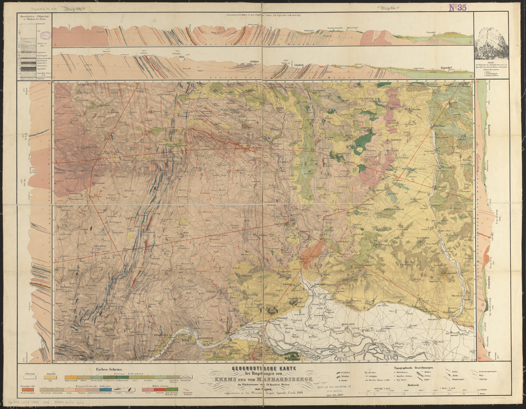
Geognostische karte der umgebungen von Krems und vom Manhardsberge : jm flächenraume von 34 quadrat meilen
Item Information
- Title:
- Geognostische karte der umgebungen von Krems und vom Manhardsberge : jm flächenraume von 34 quadrat meilen
- Cartographer:
- Cz̀jz̀ek, Joh.
- Publisher:
- K.K. Hof- und Staatsdruckerei (Austria)
- Name on Item:
-
von Joh. Cz̀jz̀ek
- Date:
-
[1849]
- Format:
-
Maps/Atlases
- Location:
-
Boston Public Library
Norman B. Leventhal Map & Education Center - Collection (local):
-
Norman B. Leventhal Map & Education Center Collection
- Subjects:
-
Geology--Austria--Lower Austria--Maps
Geology--Austria--Krems an der Donau (Politischer Bezirk)--Maps
Geology--Austria--Horn (Politischer Bezirk)--Maps
Geology--Austria--Hollabrunn (Politischer Bezirk)--Maps
Lower Austria (Austria)--Maps
- Places:
-
AustriaNiederösterreichKrems an der Donau
AustriaNiederösterreichHorn
AustriaNiederösterreichHollabrunn
- Extent:
- 1 map : color ; 50 x 76 cm
- Terms of Use:
-
No known copyright restrictions.
No known restrictions on use.
- Publisher:
-
[Vienna, Austria?] :
Lith. u. ged. in d. k.k. Hof. u. Staatsdruckerei
- Scale:
-
Scale approximately 1:69,000
- Language:
-
German
- Notes:
-
Relief shown by hachures.
"Aufgenommen in den monaten August, September, October 1849."
Includes 4 geologic cross-sections, a stratigraphic cross-section and a view of a cross-section.
- Notes (date):
-
This date is inferred.
- Identifier:
-
06_01_014255
- Call #:
-
G6493.L6C5 1849 .C95
- Barcode:
-
39999065701672


