West Indies--Caribbean Sea, harbors on the southern shore
Item Information
- Title:
- West Indies--Caribbean Sea, harbors on the southern shore
- Title (alt.):
-
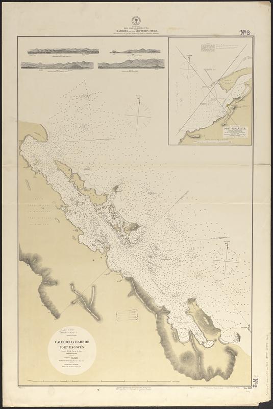
Caledonia Harbor and Port Escocés
- Issuing body:
- United States. Hydrographic Office
- Date:
-
[1875]
- Format:
-
Maps/Atlases
- Genre:
-
Nautical charts
- Location:
-
Boston Public Library
Norman B. Leventhal Map & Education Center - Collection (local):
-
Norman B. Leventhal Map & Education Center Collection
- Subjects:
-
Caledonia Bay (Panama)--Maps
Puerto Escocés (Panama)--Maps
Sasardí Bay (Panama)--Maps
Sasardí Islands (Panama)--Maps
Sabanilla Bay (Colombia)--Maps
Nautical charts--Panama--Caledonia Bay
Nautical charts--Panama--Puerto Escocés
Nautical charts--Panama--Sasardí Bay
- Places:
-
PanamaSan Blas (special territory)
ColombiaAtlántico
Bahía de Caledonia
Bahía Sukunya
Bahía Sasardí
Islas Sasardí
Bahía de Sabanilla
- Extent:
- 2 maps on 1 sheet ; 92 x 62 cm
- Terms of Use:
-
No known copyright restrictions.
No known restrictions on use.
- Publisher:
-
Washington, D.C. :
Hydrographic Office
- Scale:
-
Scale approximately 1:30,200
- Language:
-
English
- Table of Contents:
-
Caledonia Harbor and Port Escocés
Port Savanilla
- Notes:
-
Relief shown by hachures and spot heights. Depths shown by soundings and isolines.
Includes 4 coastal views.
"Cor. (VII-75)" and "Cor. VII-73, V-75."
Map of Port Sabanilla crossed out with manuscript note "Cancelled [the?] chart to no. 723."
- Notes (date):
-
This date is inferred.
- Identifier:
-
06_01_017072
- Call #:
-
G9096.P5 svar .U55 no. 383
- Barcode:
-
39999085953618


