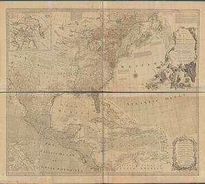
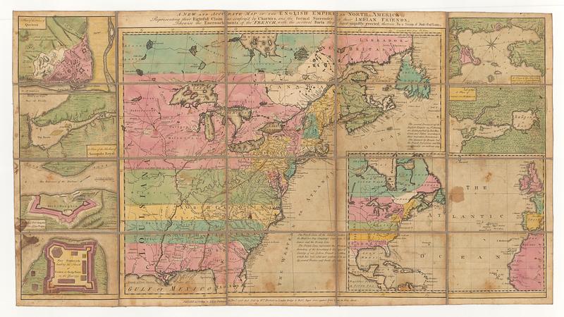
A new and accurate map of the English empire in North America: representing their rightful claim as confirm'd by charters, and the formal surrender of their Indian friends; likewise the encroachments of the French, with the several forts they have unjustly erected therein
This map is also available in American Revolutionary Geographies Online (ARGO), a collections portal especially built for material relating to the American Revolutionary War Era. Visit ARGO to learn more about this item and explore the historical geography of North America in the late eighteenth century.
Item Information
- Title:
- A new and accurate map of the English empire in North America: representing their rightful claim as confirm'd by charters, and the formal surrender of their Indian friends; likewise the encroachments of the French, with the several forts they have unjustly erected therein
- Publisher:
- Sayer, Robert, 1725-1794
- Publisher:
- Herbert, William, 1718-1795
- Creator:
- Society of Anti-Gallicans
- Name on Item:
-
by a Society of Anti-Gallicans
- Date:
-
[ca. 1755]
- Format:
-
Maps/Atlases
- Location:
- MacLean Collection Map Library
- Collection (local):
-
MacLean Collection Map Library
- Subjects:
-
North America--Maps--Early works to 1800
- Places:
-
North America (area)
- Extent:
- 1 map ; 412 x 500 mm
- Terms of Use:
-
Public Domain/No known restrictions on use. Contact host institution to download image.
Contact host institution for more information.
- Publisher:
-
London :
Sold by W.m Herbert on London Bridge & Rob.t Sayer over against Fetter Lane in Fleet Street
- Language:
-
English
- Identifier:
-
MC_902
- Call #:
-
902