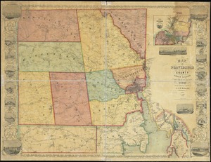
Map of the city of Providence, Rhode Island
Item Information
- Title:
- Map of the city of Providence, Rhode Island
- Cartographer:
- Walling, Henry Francis, 1825-1888
- Publisher:
- Baker, F. A.
- Name on Item:
-
from surveys under the direction of H.F. Walling ; engraved, printed, compiled & mounted at H.F. Walling's Map Establishment, no. 90 Fulton St., New York
- Date:
-
1857
- Format:
-
Maps/Atlases
- Location:
-
Boston Public Library
Norman B. Leventhal Map & Education Center - Collection (local):
-
Norman B. Leventhal Map & Education Center Collection
- Subjects:
-
Landowners--Rhode Island--Providence--Maps
Real property--Rhode Island--Providence--Maps
Providence (R.I.)--Maps
- Places:
-
Rhode IslandProvidence (county)Providence
- Extent:
- 1 map : col., dissected and mounted on linen ; 138 x 148 cm.
- Terms of Use:
-
No known copyright restrictions.
No known restrictions on use.
- Publisher:
-
Providence, R.I. :
F.A. Baker
- Scale:
-
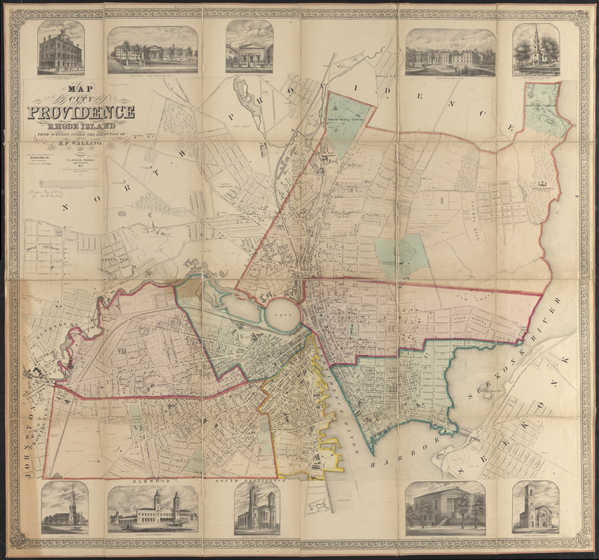
Scale 1:4,200
- Language:
-
English
- Notes:
-
Also shows ward boundaries and major landowners.
Includes concentric circles "drawn in half miles from the center of Weybosset Bridge."
Ill. of buildings in upper and lower margins: New Custom House, Post Office and U.S. court rooms -- Brown University -- Providence Institution for Savings -- Butler Hospital for the Insane -- First Baptist Meeting House -- Grace Church -- General railroad passenger station -- Central Congregational Church -- Providence Athenaeum -- Central Baptist Church.
- Identifier:
-
06_01_010578
- Call #:
-
G3774.P9 1857 .W35
- Barcode:
-
39999065675702