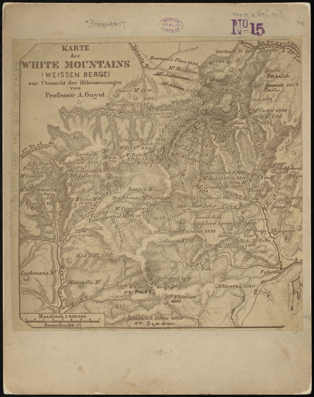
Karte der White Mountains (Weissen Berge) zur übersicht der höhenmessungen
Item Information
- Title:
- Karte der White Mountains (Weissen Berge) zur übersicht der höhenmessungen
- Creator:
- Guyot, A.
- Name on Item:
-
von Professor A. Guyot.
- Date:
-
[1870?–1879?]
- Format:
-
Maps/Atlases
- Location:
-
Boston Public Library
Norman B. Leventhal Map & Education Center - Collection (local):
-
Norman B. Leventhal Map & Education Center Collection
- Subjects:
-
White Mountains (N.H. and Me.)--Maps
- Places:
-
New HampshireWhite Mountains
- Extent:
- 1 map ; 26 x 26 cm.
- Terms of Use:
-
No known copyright restrictions.
No known restrictions on use.
- Publisher:
-
S.l :
s.n.
- Scale:
-
Scale [ca. 1:220,000]
- Language:
-
German
- Notes:
-
Photocopy of part of a map. Scale of original map given as 1:600 000. Some manuscript corrections on original map.
Mt. Adams and Mt. Jefferson shown transposed.
Relief shown by hachures and spot heights.
- Identifier:
-
06_01_010516
- Call #:
-
G3742.W52 1870 .G89
- Barcode:
-
39999065674358


