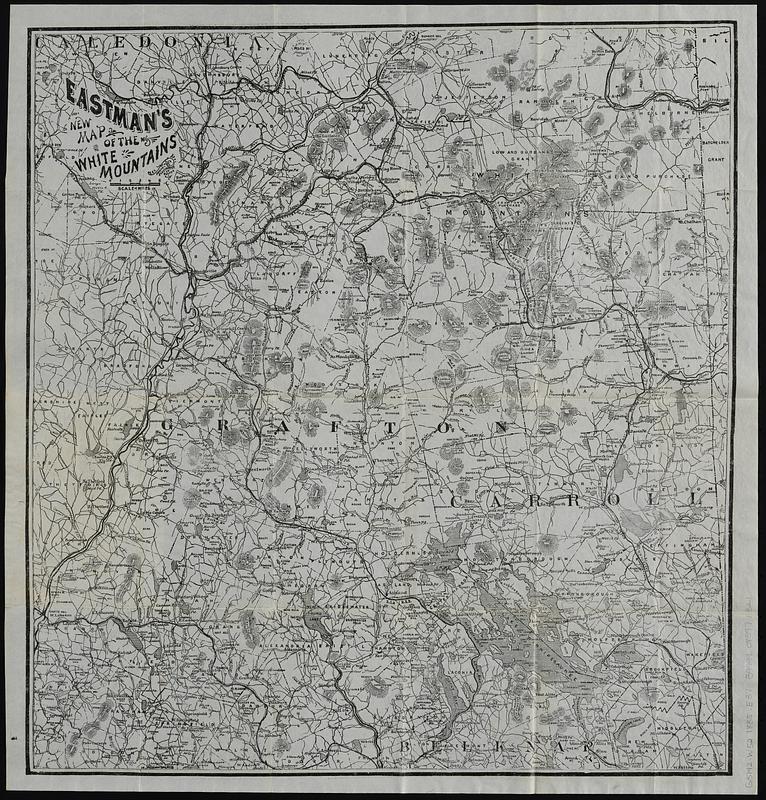
Eastman's new map of the White Mountains
Item Information
- Title:
- Eastman's new map of the White Mountains
- Title (alt.):
-
Eastman's map of the Mountain & Lake Region of N.H.
New map of the White Mountains
- Publisher:
- Eastman, Edson Cummings, 1832-1911
- Printer:
- Photo-Electrotype Co. (Boston, Mass.)
- Date:
-
[ca. 1885]
- Format:
-
Maps/Atlases
- Location:
-
Boston Public Library
Norman B. Leventhal Map & Education Center - Collection (local):
-
Norman B. Leventhal Map & Education Center Collection
- Subjects:
-
White Mountains (N.H. and Me.)--Maps
- Places:
-
New HampshireWhite Mountains
- Extent:
- 1 map ; 45 x 43 cm, folded in covers 14 x 10 cm
- Terms of Use:
-
No known copyright restrictions.
No known restrictions on use.
- Publisher:
-
Concord, N.H.; Boston :
Edson C. Eastman; Photo-Electrotype Co.
- Scale:
-
Scale approximately 1:265,000
- Language:
-
English
- Notes:
-
Relief shown by hachures.
"This map has been prepared with great care. It was designed to accompany Eastman's White Mountain guide book. It shows all the railroads, rivers, roads, lakes, the prominent mountains and location of the principal hotels in the mountain region, and is sufficiently correct for all practical purposes. It is drawn on a scale of four miles to an inch. As it is thought that many would prefer the map in a separate form, as more convenient for consultation, it is published in the present style. Price 40 cents per copy."--Page 2 of cover.
List of Eastman publications on page 2 of cover lists Eastman's White Mountain guide book as a "New Edition".
Cover title: Eastman's map of the Mountain & Lake Region of N.H.
- Identifier:
-
06_01_019124
- Call #:
-
G3742.W52 1885 .E37
- Barcode:
-
39999085971321