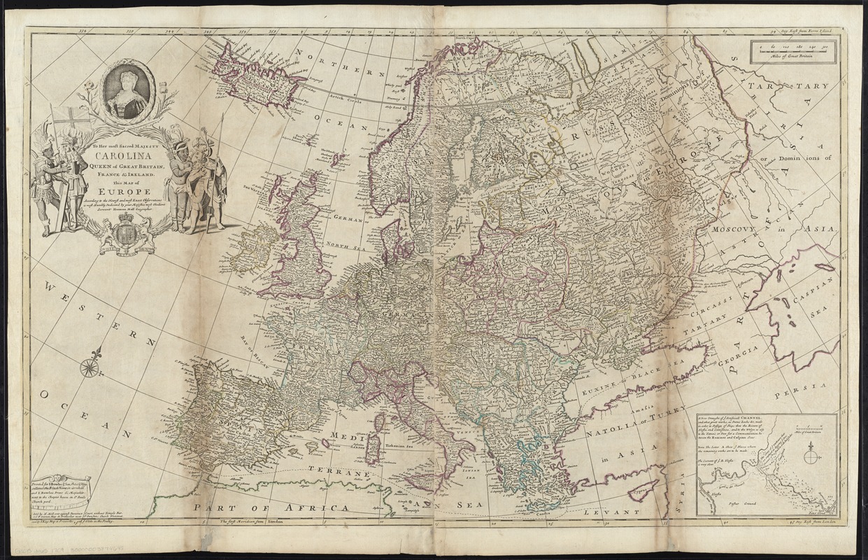
To Her most Sacred Majesty Carolina Queen of Great Britain, France & Ireland, this map of Europe, according to the newest and most exact observations, is most humbly dedicated
Item Information
- Title:
- To Her most Sacred Majesty Carolina Queen of Great Britain, France & Ireland, this map of Europe, according to the newest and most exact observations, is most humbly dedicated
- Title (alt.):
-
This map of Europe according to the newest and most exact observations
Map of Europe according to the newest and most exact observations
- Creator:
- Moll, Herman, d. 1732
- Name on Item:
-
by your Majesties most Obedient Servant Herman Moll Geographer.
- Date:
-
[1730?]
- Format:
-
Maps/Atlases
- Location:
-
Boston Public Library
Norman B. Leventhal Map & Education Center - Collection (local):
-
Norman B. Leventhal Map & Education Center Collection
- Subjects:
-
Europe--Maps--Early works to 1800
Caroline, Queen, consort of George II, King of Great Britain, 1683-1737
- Places:
-
Europe
Europe
- Extent:
- 1 map : hand col. ; 57 x 96 cm.
- Terms of Use:
-
No known copyright restrictions.
No known restrictions on use.
- Publisher:
-
[London] :
Printed for I. Bowles & Son ... and T. Bowles ; Sold by H. Moll ... and P. Overton ... and by I. King
- Scale:
-
Scale [ca. 1:6,300,000]
- Language:
-
English
- Notes:
-
Prime meridians: London and Ferro.
Relief shown pictorially.
Dedicated to Caroline (Princess Caroline of Brandenburg-Ansbach, 1683-1737), Queen of Great Britain and Ireland, and Electress of Hanover, Consort of George II, who ascended to the throne in 1727.
Inset: A new draught of ye artificiall channel, and other great works, as dams locks &c. made in order to passage of ships thro the rivers of Ilafla and Camisinca, and to the Wolga ...
Appears in Moll's The world described, [1709-1736], plate 3.
- Identifier:
-
06_01_009657
- Call #:
-
G1015 .M65 1709
- Barcode:
-
30000003874645