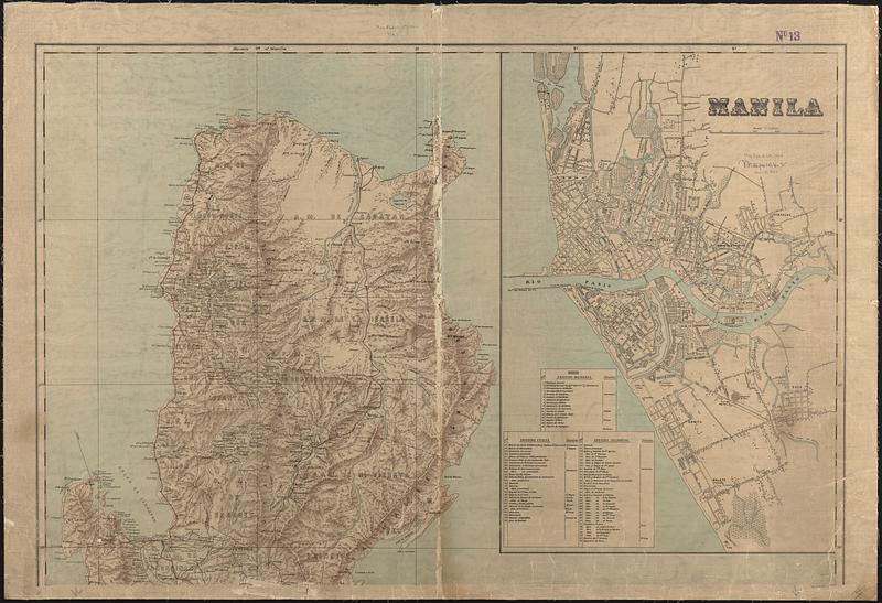
Military map of the isle of Luzon

Item Information
- Title:
- Military map of the isle of Luzon
- Cartographer:
- United States. Adjutant-General's Office. Military Information Division
- Lithographer:
- Julius Bien & Co.
- Name on Item:
-
prepared in the War Department, Adjutant General's Office, Military Information Division, from the latest official sources
- Date:
-
1900
- Format:
-
Maps/Atlases
- Location:
-
Boston Public Library
Norman B. Leventhal Map & Education Center - Collection (local):
-
Norman B. Leventhal Map & Education Center Collection
- Subjects:
-
Luzon (Philippines)--Maps
Manila (Philippines)--Maps
- Places:
-
PhilippinesLuzon (island)
PhilippinesManila
- Extent:
- 1 map on 2 sheets : color ; 131 x 97 cm, on sheets 73 x 107 cm
- Terms of Use:
-
No known copyright restrictions.
No known restrictions on use.
- Publisher:
-
[Washington, D.C.] :
War Department, Adjutant General's Office, Military Information Division
- Scale:
-
Scale approximately 1:550,000
- Language:
-
English
Spanish
- Notes:
-
Relief shown by shading.
Prime meridian: Manila.
Inset: Manila.
- Notes (language):
-
Title and headings in English. Notes and indexes in Spanish.
- Identifier:
-
06_01_015338A
06_01_015338B
- Call #:
-
G8062.L8 1900 .U55
- Barcode:
-
39999085935268


