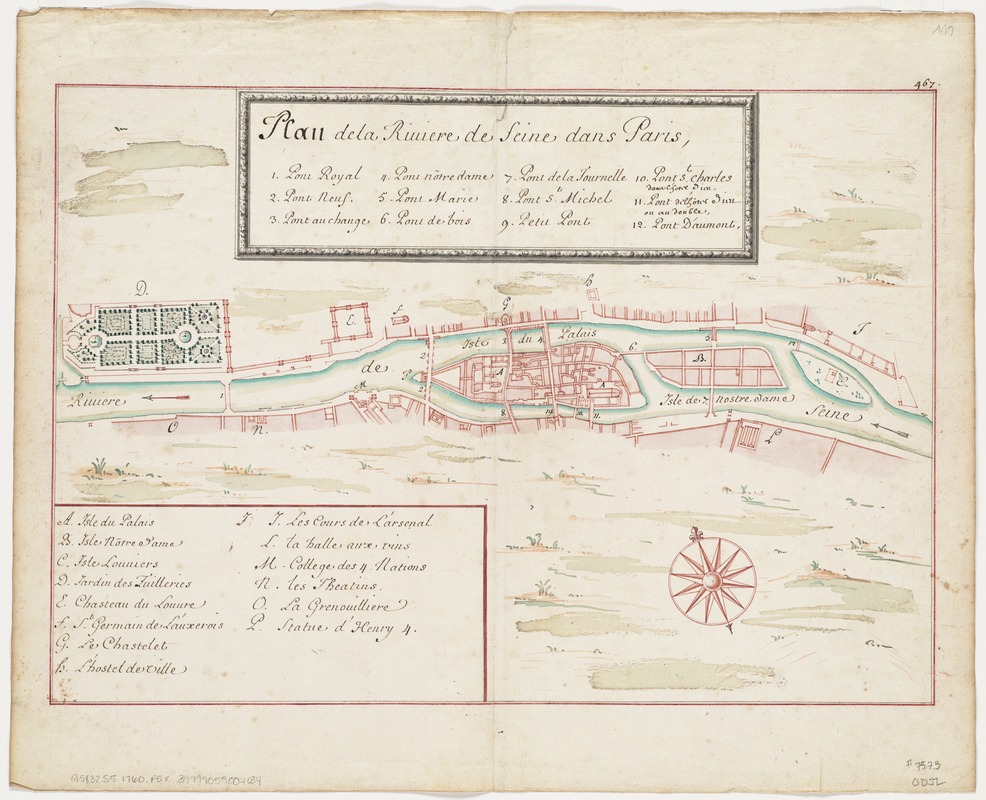
Plan de la Riviere de Seine dans Paris
Item Information
- Title:
- Plan de la Riviere de Seine dans Paris
- Date:
-
[1760]
- Format:
-
Maps/Atlases
Manuscripts
- Location:
-
Boston Public Library
Norman B. Leventhal Map & Education Center - Collection (local):
-
Norman B. Leventhal Map & Education Center Collection
- Subjects:
-
Seine River (France)--Maps, Manuscript--Early works to 1800
Paris (France)--Maps, Manuscript--Early works to 1800
- Places:
-
FranceÎle-de-France (region)Paris
FranceSeine River
- Extent:
- 1 ms. map : col. ; 29 x 42 cm.
- Terms of Use:
-
No known copyright restrictions.
No known restrictions on use.
- Scale:
-
Scale not given.
- Language:
-
French
- Notes:
-
Oriented with north toward the lower right.
Manuscript map of the River Seine in watercolor.
"467" in top right corner margin.
- Notes (date):
-
This date is inferred.
- Identifier:
-
06_01_004123
- Call #:
-
G5832.S5 1760 .P5x
- Barcode:
-
39999059004034


