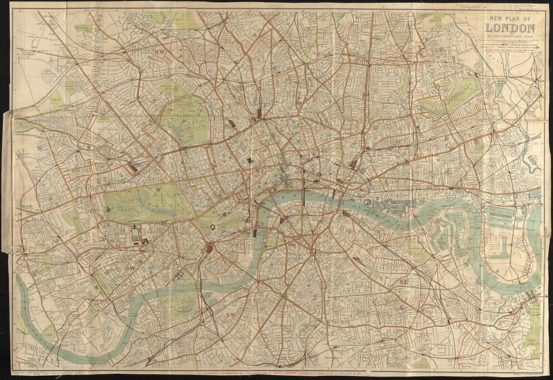
New plan of London
Item Information
- Title:
- New plan of London
- Title (alt.):
-
W.H. Smith & Son's plan & guide, London
- Cartographer:
- Bartholomew, John, 1831-1893
- Copyright holder:
- John Bartholomew & Co.
- Publisher:
- W.H. Smith & Son
- Name on Item:
-
by John Bartholomew, F.R.G.S.
- Date:
-
[ca. 1895]
- Format:
-
Maps/Atlases
- Location:
-
Boston Public Library
Norman B. Leventhal Map & Education Center - Collection (local):
-
Norman B. Leventhal Map & Education Center Collection
- Subjects:
-
London (England)--Maps
London (England)--Guidebooks
Streets--England--London--Maps
- Places:
-
EnglandLondon
- Extent:
- 1 map : color ; 56 x 82 cm, folded in cover 19 x 10 cm + guidebook (37 pages ; 19 cm)
- Terms of Use:
-
No known copyright restrictions.
No known restrictions on use.
- Publisher:
-
London :
W.H. Smith & Son, 186, Strand, & all railway bookstalls
- Scale:
-
Scale approximately 1:19,400
- Language:
-
English
- Notes:
-
Relief shown by hachures and spot heights.
"Copyright John Bartholomew & Co."
Place of publication and publisher statement from cover.
Publication date from Hyde.
Note in lower margin about continuation southwards.
Accompanied by guidebook: Visitors' guide to London (37 pages ; 19 cm).
- Notes (citation):
-
Hyde, R. Printed maps of Victorian London, no. 155 (13)
- Identifier:
-
06_01_017376
- Call #:
-
G5754.L7 1895 .B37
- Barcode:
-
39999085956967


